
Share this @internewscast.com
Tropical Storm Melissa is slowly making its way across the Caribbean Sea, poised to bring potentially life-threatening floods and mudslides to the region in the coming days. This development serves as a reminder that the Atlantic hurricane season is far from over, with Melissa having ample time and energy to intensify.
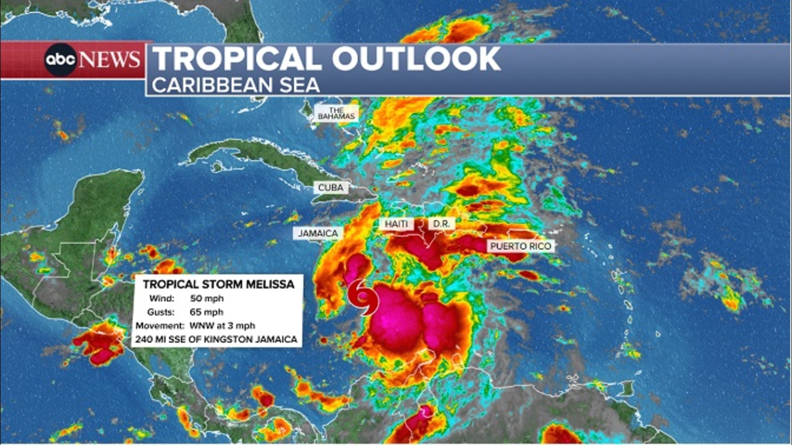
As of Wednesday afternoon, the National Hurricane Center reported Melissa’s location approximately 300 miles southeast of Kingston, Jamaica, carrying maximum sustained winds of 50 mph. The storm is advancing at a sluggish pace of just 2 mph.
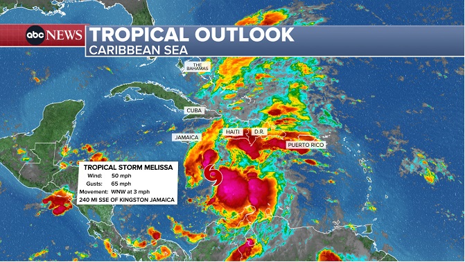
Already, heavy rainfall is spreading northward as Melissa inches closer to Jamaica and Haiti. Forecasts indicate that southern parts of Haiti and the Dominican Republic could receive over a foot of rain by the weekend. Such significant rainfall over the region’s mountainous terrain poses a high risk of severe flash flooding and landslides.
The storm is traversing warm waters that act as a powerful catalyst for storms during this late stage of the season. Melissa is anticipated to reach hurricane strength by Saturday morning.
If it achieves hurricane status, Melissa will be the fifth hurricane of the 2025 Atlantic season and the first to originate in the Caribbean. Furthermore, projections suggest it could evolve into the season’s fourth major hurricane, classified as Category 3 or higher.
A hurricane watch is currently in place for sections of Haiti, while Jamaica is under a tropical storm watch. While the likelihood of Melissa impacting the mainland United States remains low, it cannot be completely ruled out as meteorologists continue to monitor the situation closely.
Here’s what we know so far.
Two possible outcomes, neither good
Melissa’s exact track is still tricky to pin down, but there are two main scenarios. The possibilities have changed slightly from initial forecasts, but both place Hispaniola and Jamaica in harm’s way.
Melissa could bring close to a foot of rain to parts of Hispaniola, which is the island that houses the Dominican Republic and Haiti, as it drifts closer to the island through the weekend.
It’s still unclear exactly what parts of Haiti and the Dominican Republic would be subject to the heaviest rain, but the combination of torrential rain and mountainous terrain is a recipe for dangerous flash flooding and mudslides. Jamaica could also receive torrential, flooding rainfall beginning later this week.
The islands will also face strong, potentially damaging winds from Melissa, especially after it reaches hurricane strength Saturday, according to the hurricane center’s forecast.
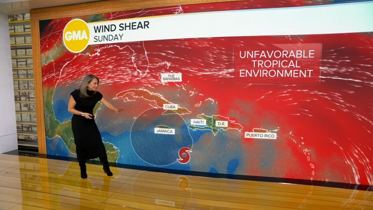
Slow-moving storms like Melissa hit the same areas with torrential rain and strong winds for days, significantly increasing rainfall totals and the likelihood of power outages. Melissa will start moving quicker at some point, and exactly when and where that happens is extremely important to determine its impacts. It’s also still quite unclear.
If Melissa’s current forecast track holds and the storm moves slowly west toward an area south of Jamaica into early next week, it could end up where the atmosphere and extremely warm water align to boost the storm.
Melissa is now expected to become at least a Category 4 major hurricane by Monday.
Its anticipated explosion in strength from tapping into that energy is something that’s happening more often as the world warms due to fossil fuel pollution. Just this year, three of the four Atlantic hurricanes to date underwent extreme rapid intensification: Erin, Gabrielle and Humberto.
A stronger Melissa would eventually turn northeast next week and threaten other portions of the Caribbean, like Cuba. That scenario would increase the intensity of all of Melissa’s impacts from rain to wind and dangerous seas.
Alternatively, there’s still a chance that another weather pattern could pull Melissa north toward Jamaica or Haiti early next week. This path would likely prevent Melissa from reaching the strength it might in the first scenario, but could also mean a direct landfall and more concentrated impacts in either location.
Is this a threat to the US?
A direct hit on the mainland US is unlikely, but not impossible. At this time, the storm’s most likely impact to the US could be some rough surf and rip currents along the East Coast next week.
Florida could be in play if Melissa takes a turn to the north later than currently expected. In that case, Cuba and parts of the Bahamas could also be hit with Melissa’s wind and rain.
The odds of a hurricane landfall in the US really dwindle at the end of October and into November, but there have been notable late-season exceptions. Most recently, Hurricane Nicole slammed into Florida as a Category 1 in early November 2022 and Hurricane Zeta smashed into Louisiana as a Category 3 in late October 2020.
As Melissa continues to develop in the coming days, its track, strength and threats will come into sharper focus.
Atlantic hurricane season officially ends on November 30, though tropical systems can still form after that date.