

On Tuesday, California’s Central Valley experienced a rare surge of tornado activity, with three tornadoes touching down in rapid succession, as indicated by a preliminary report from the National Weather Service.
This unusual meteorological event took place in Fresno and Madera Counties, as a powerful storm system moved through the area. The storm brought heavy rain, strong winds, and hail, but fortunately, the region avoided any injuries or substantial damage.
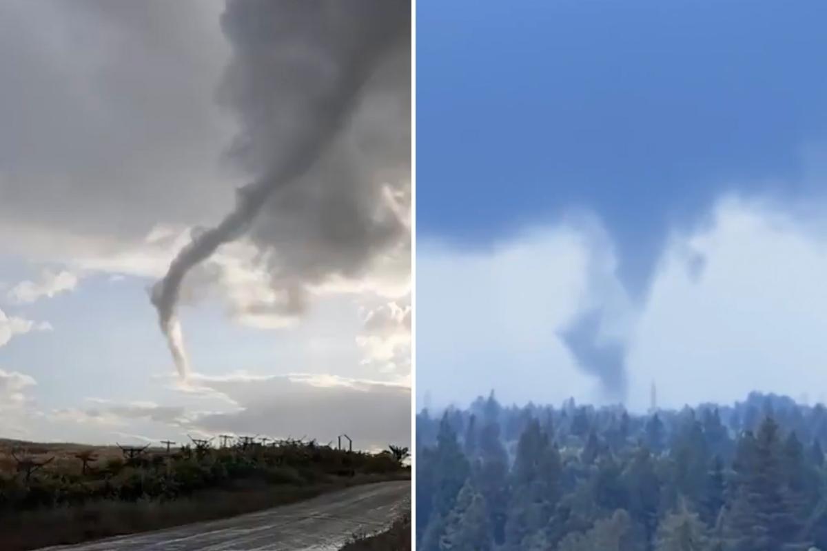
Despite numerous funnel clouds forming, only a few actually touched down, meeting the criteria to be officially recognized as tornadoes.
Meteorologists recorded the first tornado touching down at 2:10 p.m. near the community of Biola.
This brief tornado traveled through a walnut grove, causing damage to trees with winds reaching over 70 mph. It left a path of destruction about 150 feet long, equivalent to half the length of a football field.
It was categorized as an EF0 tornado, the weakest rating on the enhanced Fujita scale.
Just over an hour later, a stronger tornado formed west of Atwater.
Packing winds up to 95 mph, it traveled about half a mile and snapped trees along its path, earning an EF1 rating.
A third tornado struck at 5:09 p.m. northeast of Clovis. Matching the second storm’s distance but hitting harder, it generated winds reaching 110 mph and caused damage to several homes.
In total, officials estimate that at least 20 funnel clouds were seen during the outbreak.
While such formations aren’t especially rare in the region, most never reach the ground.
Tornadoes themselves, however, remain a rarity in California.
Data from Golden Gate Weather Service shows that between 1950 and 2025, just 487 tornadoes have been confirmed statewide.
Days with three or more tornadoes are especially uncommon, occurring only about two dozen times over that span.
The Central Valley and coastal Southern California see the bulk of the state’s tornado activity, with Los Angeles County leading in total reports, though higher population density may play a role in detection rates.
Tuesday’s event came down to a perfect mix of atmospheric ingredients.
A moisture-rich system rolling in from the Pacific combined with daytime heating after cloud cover broke, creating unstable conditions that fueled thunderstorm development.
Download The California Post App, follow us on social, and subscribe to our newsletters
California Post News: Facebook, Instagram, TikTok, X, YouTube, WhatsApp, LinkedIn
California Post Sports Facebook, Instagram, TikTok, YouTube, X
California Post Opinion
California Post Newsletters: Sign up here!
California Post App: Download here!
Home delivery: Sign up here!
Page Six Hollywood: Sign up here!