
The heat is about to lock in for the new week. First, the near-term concern is reduced visibility from fog for Monday morning.
Fog Possible
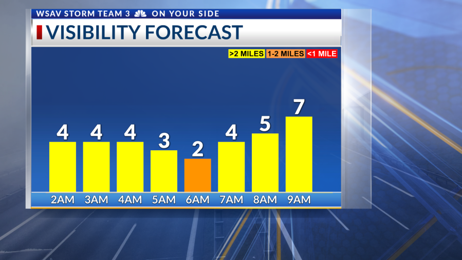
Light winds, clear skies, and abundant moisture will lead to the formation of fog in some areas. This fog issue will be more pronounced in areas inland of I-95, as coastal winds will maintain some activity.
The fog will quickly clear after sunrise, giving way to mainly sunny skies on Monday. A heat dome over the Eastern US will initiate a hot weather period.


Heat
Ensure you stay hydrated, avoid overexertion outside, wear lightweight and reflective clothing, and watch for symptoms of heat-related illnesses in yourself and others. It’s crucial to check on elderly and vulnerable neighbors to ensure they remain cool and comfortable.
Temperatures Monday will reach into the mid-90s with a heat index of 100°-103°. Temperatures and humidity will both go up a notch for Tuesday and Wednesday. Heat alerts are possible at times this week as heat index values may reach 105°-110° Tuesday through Friday.


