Share this @internewscast.com
SAVANNAH, Ga. ( ) – Scattered storms will persist over the weekend as a cold front moves in. Expect cloudy skies with temperatures around the low to mid-80s, aligning with seasonal averages. The front will stall off our coast tomorrow as we start monitoring the tropics.

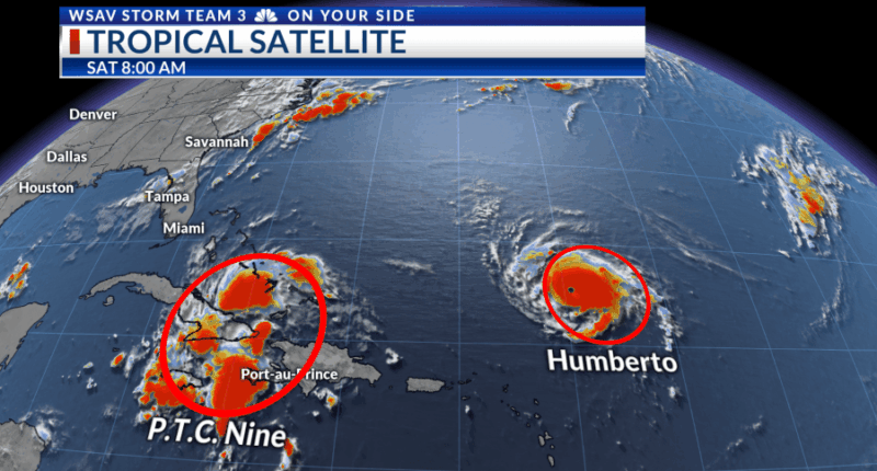
According to the 8 am NHC update, Potential Tropical Cyclone Nine has sustained winds of 35 mph and a minimum pressure of 1007 mb. It is currently moving very slowly at 8 mph towards the northwest. The P.T.C. label is due to the potential of this system evolving into a tropical depression or storm later today. The Bahamas have issued tropical storm watches and warnings. A consensus is forming among global and hurricane models regarding this system’s trajectory towards the southeastern U.S. coast by early next week, before Hurricane Humberto redirects it out to sea.
The NHC’s official forecast suggests P.T.C. Nine will become Tropical Depression Imelda on Saturday, developing into a tropical storm on Sunday, and potentially a hurricane by Monday or Tuesday. While models anticipate Humberto will draw this storm back out to sea, impacts along the Coastal Empire and Lowcountry could still occur from Monday to Wednesday next week. These impacts may involve strong winds, tornadoes, minor coastal flooding, inland flooding from prolonged heavy rainfall, and coastal issues like storm surges, high surf, and rip currents. The predicted impact magnitude will be refined as more precise information on the storm’s size, path, and speed is obtained in the coming days.
Hurricane Humberto reached category 4 status as of 8 am today, with sustained winds of 145 mph and a minimum pressure of 940 mb. It is moving west at a slow pace of 7 mph. Humberto is forecasted to potentially strengthen into a category 5 hurricane over the next day or so, moving generally toward Bermuda. It is expected to remain well east of the U.S. and just west of Bermuda early next week, eventually turning northeast by Wednesday, avoiding a Bermuda landfall. As Humberto intensifies, it is likely to draw future Imelda out to sea with it. We will continue monitoring and updating as new information becomes available.


