
ORLANDO, Fla. – Following a chilly start in east Central Florida, temperatures are set to rise steadily throughout the afternoon, with a warming trend expected to continue into the middle of the week.
Monday
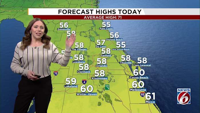
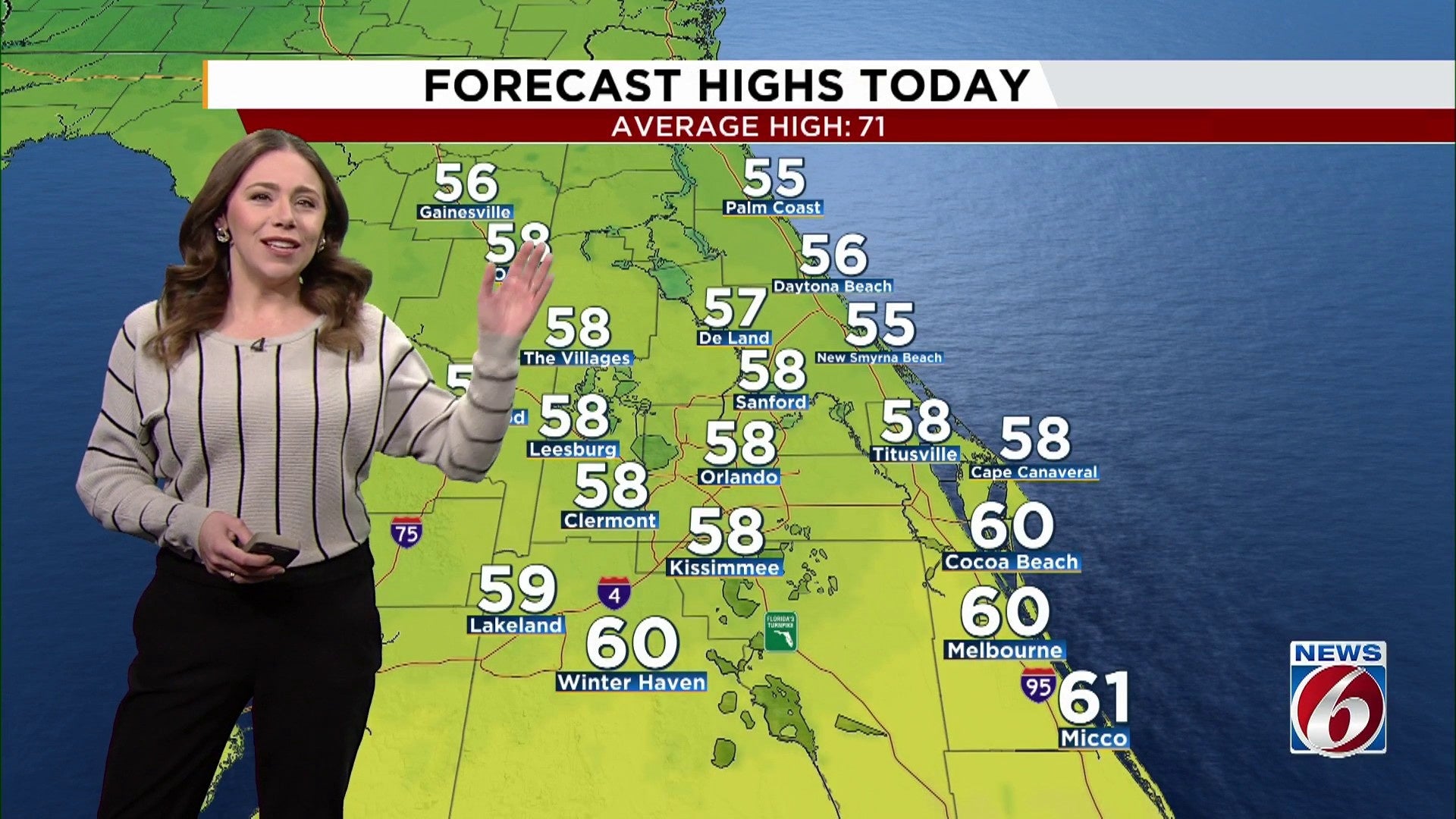
Despite the frosty morning, expect abundant sunshine on Monday as dry air replaces Sunday’s cold front. While the sun will shine brightly, temperatures will hover well below the seasonal norm, ranging from the mid-50s to the mid-60s during the afternoon.
As Monday night approaches, the weather remains dry with diminishing winds, which will allow temperatures to dip once again. Inland areas west of Interstate 95 can expect lows in the mid to upper 30s, while coastal regions will remain a bit warmer in the 40s.
In some rural interior areas, there is a potential for patchy frost to develop.
Early week
High pressure remains in control through midweek, keeping rain out of the area. A warming trend kicks off, with highs reaching the upper 60s to low 70s by Wednesday.
Lake week
Forecast confidence decreases heading into late week, but temperatures are expected to continue trending warmer, nearing 80 by the weekend
A disturbance offshore in the Atlantic could help push some scattered showers by Thursday and Friday, with the highest chance along the coast. At this point, coverage remains low at 20-30%.
Copyright 2026 by WKMG ClickOrlando – All rights reserved.