ORLANDO, Fla. – As Friday night progresses, the skies over Orlando will continue to clear, paving the way for a noticeable drop in temperatures. Expect the mercury to dip into the upper 40s to the mid-50s, creating a crisp night across the region.
Looking ahead to Saturday morning, there’s a possibility of patchy dense fog forming in certain areas, so motorists should be cautious during early travels.
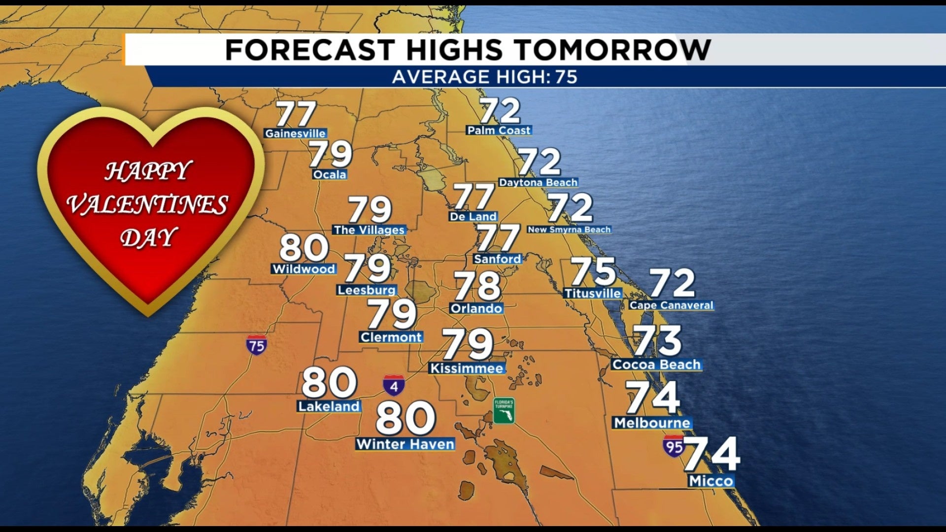
SATURDAY (VALENTINE’S DAY)
Valentine’s Day promises to be mostly dry and pleasantly warm, setting the stage for a delightful day. Inland temperatures will climb to the upper 70s, potentially reaching near 80 degrees, while coastal areas will enjoy milder conditions with highs in the mid to upper 70s. Although a brief, isolated shower might develop near the coast, particularly from Cape Canaveral southward, the majority of the region is expected to stay rain-free.
SUNDAY
SUNDAY
Sunday turns breezy and even warmer, with inland highs climbing into the low 80s as clouds increase through the day.
NEXT WEEK
Rain chances ramp up late Sunday as a cold front approaches Central Florida.
The best shot for more widespread showers comes after sunset Sunday and continues overnight into early Monday, which could lead to slick spots for the morning commute.
Rainfall totals look light to moderate, generally under a half inch, though timing may still change.
There is a marginal risk in place for most of Central Florida for strong to severe storms developing. Impacts include heavy rain at times, strong gusty winds up to 60 mph, and lightning.
Drier, warmer weather returns Tuesday through Thursday, with mostly sunny skies and highs back in the 80s.
Copyright 2026 by WKMG ClickOrlando – All rights reserved.