
Share this @internewscast.com
In brief
- A topical low pressure system northeast of Cooktown is making its way towards the Queensland coast.
- Bureau of Meteorology rates the low pressure system as a moderate chance of becoming a category one cyclone.
Australia’s far northern region is gearing up once again to face potential severe weather, as a tropical cyclone could strike the coast in the coming days.
Currently, a tropical low-pressure system is positioned northeast of Cooktown, gradually making its way westward toward Queensland’s shoreline.
Cairns, a popular tourist destination, is expected to bear the brunt of this system when it makes landfall on Friday morning.
The Bureau of Meteorology has assessed the system as having a moderate likelihood of developing into a category one cyclone, prompting a watch from Cooktown to Palm Island in the Wet Tropics.
Angus Hines, a senior meteorologist, indicated that the watch area could experience gale-force winds reaching speeds of up to 100 km/h, with widespread heavy rainfall expected to affect a much broader region.
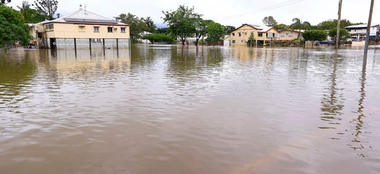
There is an active flood watch for the already saturated catchments in the northern and far northern areas.
The bureau forecasts the system will track westwards towards the Gulf of Carpentaria over the weekend.
It is unwelcome news for graziers, who have already lost an estimated 100,000 stock after major flooding hit the Gulf Country in January.
“We’ve seen frequent bouts of wet weather across both the north and interior of Queensland in recent months, and there’s a really prolonged, ongoing flood situation across much of the state,” Mr Hines said.
“We’ve got rivers running extremely high at the moment.”
Mr Hines said another tropical low in the Indian Ocean was a chance of developing into a cyclone in the coming days.
He said the next cyclone to form will be named Narelle, followed by Owen, with cyclones named in alphabetical and chronological order.
Parts of the tropical coast have already triggered torrential downpours, with almost 300mm of rain falling at multiple weather stations in a 24 hour period up to Monday morning.
The far north’s Hinchinbrook Mayor Ramon Jayo said the shire was grateful for a brief break in the weather, but “we’ll just wait and see what the next avalanche brings”.
“To tell you the truth, it’s probably been one of those traditional old wet seasons. It’s a lot of rain,” he said.
“But we haven’t had any major flooding of significance causing any damage.”
Mr Hines said the likelihood of the system heading towards highly populated areas in southeast Queensland had abated.
“It’s still not quite at the point where we can completely rule that out,” he said.
“But the more likely scenario is certainly shaping up to be that this weather system will stay in the northern part of the state and gradually track westward.”
For the latest from SBS News, download our app and subscribe to our newsletter.