

Sea breeze weather pattern is beginning to establish itself.
ORLANDO, Fla. – Earlier today, Central Florida experienced scattered showers primarily affecting areas between I-4 and I-75. As the evening progresses, these showers are expected to diminish by 9 p.m., paving the way for a mild night characterized by a touch of humidity and occasional cloud cover. Overnight temperatures are anticipated to settle into the low to mid-70s.
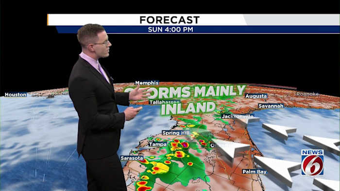
Sunday promises a bright start with plenty of sunshine interspersed with a few harmless clouds. Those planning to enjoy a brunch will find the weather accommodating, with dry conditions persisting through the morning. However, it will be slightly more humid compared to Saturday. Temperatures are forecasted to climb into the low 90s, with isolated thunderstorms likely to develop along the Atlantic sea breeze later in the day.
The steering winds will begin to pick up from the Atlantic, causing most of the showers to move westward from downtown Orlando toward the I-75 corridor as the afternoon unfolds. A 30% chance of scattered storms is expected from mid to late afternoon.
This onshore flow is set to continue into the start of next week, resulting in isolated to scattered sea breeze storms each afternoon. This pattern indicates a gradual shift towards the rainy season, as afternoon thunderstorms become a more common occurrence.