

A brewing storm system over the Gulf is set to unleash heavy rains across Louisiana and other Gulf Coast regions starting Friday, with the intensity expected to escalate over the weekend.
The mere presence of a disturbed water area in the Gulf during hurricane season often triggers concern.
However, the FOX Forecast Center assures that this system poses no risk of developing into a tropical depression or storm.
Despite Gulf sea surface temperatures being up to 3 degrees warmer than usual, strong wind shear is preventing any thunderstorms from organizing.
While tropical formation isn’t anticipated, the system is rich in tropical moisture and is likely to cause coastal flooding, rough surf, and rip currents along the Louisiana and Mississippi coastlines.
In response to hazardous conditions, Orange Beach in Alabama was closed to swimmers on Thursday, as city officials reported life-threatening rip currents already affecting the Gulf Coast.
Because the storms will be scattered, the potential for widespread flooding is limited.
However, any individual storm could produce torrential downpours, where rainfall totals over 2 inches per hour are likely.
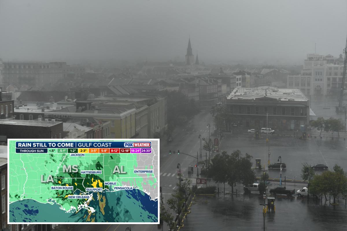
The New Orleans, Biloxi, and Gulfport metro areas are among those most likely to see the heaviest rain, with storms peaking on Saturday.
If multiple storms track over the same area, more than 3 inches of rain and flooding will be possible.
NOAA’s Weather Prediction Center (WPC) has issued a Level 1 out of 4 flash flood threat for the Louisiana, Mississippi, and Alabama Gulf Coast through Sunday.
The flood risk will expand into the Plains and Midwest over the weekend as more tropical moisture spreads across the region.
Meanwhile, east-southeast winds with gusts up to 40 mph will pile up water at the coast, leading to dangerous surf, strong rip currents, and minor flooding during high tide.
Coastal Flood Advisories have been issued from southeast Louisiana to the Mississippi coast for the threat of 1 to 2 feet of total water rise, which will cause flooding in low-lying parks and parking lots.
Much of the Southeast has seen several rounds of soaking storms over the last two weeks and could be vulnerable to additional flash flooding.
By Sunday, the moisture will have moved inland, where it will meet up with an upper-level disturbance tracking out of the Four Corners region.
The two systems will combine to trigger numerous thunderstorms across the Lower and Mid-Mississippi valleys on Sunday afternoon across parts of eastern Kansas, eastern Oklahoma, Missouri and northwestern Arkansas.