

ORLANDO, Fla. – Central Florida is heading into a familiar early-July weather rhythm, featuring steamy afternoons, high humidity and scattered showers and storms. That pattern is expected to hold through the remainder of the holiday week and into the Fourth of July weekend.
WEDNESDAY & THURSDAY
Rain chances should ease slightly during the middle of the work week, with coverage around 30-40% for areas well inland.
Afternoon highs are forecast to reach the upper 80s to lower 90s, but muggy conditions will make it feel more like the upper 90s to low 100s.
HOLIDAY WEEKEND
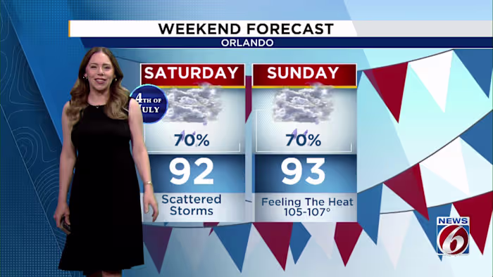
Storm chances are expected to ramp up as the holiday weekend gets underway.
Each day will bring a blend of sunshine and clouds, followed by scattered thunderstorms during the afternoon and evening as sea breezes push inland and interact. Rain and storm coverage is projected to rise to 60-80%, with stronger cells capable of producing downpours, frequent lightning and gusty winds.
Temperatures will remain hotter than average, with highs in the low to mid 90s and heat index values reaching 100 to 107 degrees before storms form each afternoon.
If you have outdoor plans for the holiday weekend, the best advice is to schedule activities during the morning hours and keep a close eye on the the News6 Weather App during the afternoon, when storms become much more likely.