

Thunderstorms once again pushing from west to east.
Sunday
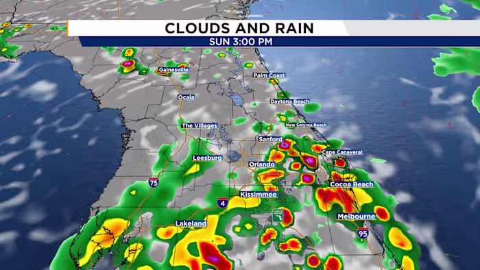
Sunday’s weather pattern will look much like the previous day, with deep tropical moisture continuing to move in from the south while a trough settles into the Southeast to our north. The morning should stay dry and sunny, helping temperatures climb back into the low to mid-90s. Heat index values will make it feel closer to 100 to 105 degrees. By late morning, showers and thunderstorms are expected to develop near the I-75 corridor between 11 a.m. and noon, then move toward the I-4 corridor around 2 p.m. before reaching areas near I-95 late in the afternoon. Most storms should weaken and fade by sunset.
Week Ahead
Rain chances will stay higher than usual Monday and Tuesday as leftover moisture remains in place. Most of the activity will come from afternoon sea breeze storms, with some downpours likely to linger into the evening commute.
A shift in the pattern arrives by midweek as high pressure builds over Florida and a new plume of Saharan dust moves in. Together, those factors will lower rain chances to about 20% to 30% by the middle of the week. Temperatures, however, will heat up even more, with highs reaching the mid to upper 90s through the second half of the week and into next weekend.