

ORLANDO, Fla. – Oppressive heat will hold firm through the weekend as an upper-level ridge of high pressure combines with Saharan dust, creating a setup that favors dangerously hot conditions.
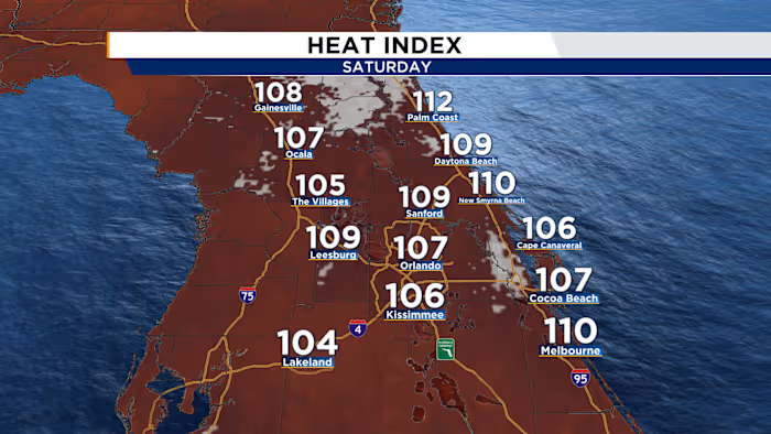
The heat stays intense as a denser batch of Saharan dust moves in alongside the strong ridge overhead. Afternoon highs are expected to push back into the mid- to upper 90s, while heat index values could climb as high as 112ºF. Heat advisories will likely be needed Saturday.
There will be one small change: a modest increase in moisture as a cold front slides into the Panhandle, which should allow rain chances to rise just enough to bring some brief relief. Still, the combination of dust and high pressure should delay storm development, with showers forming around mid-afternoon and lingering a bit past sunset. Rain coverage is expected to top out near 40% around 5 p.m.
By Sunday, an even thicker surge of Saharan dust will be in place over Central Florida. That will help keep temperatures blazing while also limiting the potential for widespread showers. With moisture from the front lingering over the Panhandle, the forecast will come down to a tug-of-war between that moisture and the incoming dust. The better moisture appears more likely to stay from Marion County northward, with rain chances decreasing farther south as the dust spreads in. Highs will reach the mid-90s, with heat index readings up to 108ºF.


