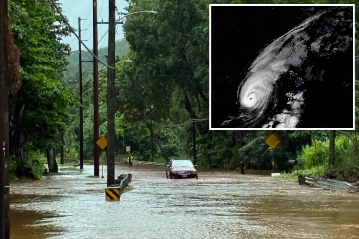

HONOLULU — Hurricane Lowell, a strong Category 2 storm, delivered a rare direct strike to Hawaii’s western islands late Monday night, local time, unleashing damaging winds and heavy rain across the state. The severe weather left tens of thousands of customers without electricity on Kaua’i and Oahu, Hawaii’s most populated island.
Although Lowell’s eye did not officially cross land, forecasters classify the event as a direct hit because the hurricane passed close enough to the islands. That designation applies when a storm moves within a distance up to twice the span between its center and the area of peak winds — about 70 miles in Lowell’s case.
The center of Hurricane Lowell is now starting to move away to the north-northwest of Ni’ihau while maintaining Category 2 strength, packing maximum sustained winds of 105 mph.
According to the National Hurricane Center, the storm is tracking north-northeast at 18 mph.
Power outages have mounted quickly, with more than 60,000 customers on Kaua’i and Oahu combined left in the dark, according to poweroutage.us. On Kaua’i alone, more than 90% of the island has lost power.
Kaua’i has taken the brunt of Lowell’s force so far, including wind gusts topping 80 mph along the island’s eastern side.
FOX Weather Correspondent Katie Byrne reported intense wind gusts, flash flooding and several feet of storm surge in Kōloa on Kaua’i from late Monday night into the early hours of Tuesday.
Hawaii Gov. Josh Green had already issued a state of emergency last Thursday as officials prepared for Lowell’s potential impacts.
Sustained winds between 65 and 85 mph have been recorded on Ni’ihau.
The National Weather Service (NWS) has issued a rare Tornado Watch in parts of Hawaii through 4 a.m. Officials said this is the first Tornado Watch issued by NWS Honolulu since at least 2008.
A Hurricane Warning was issued for Kauaʻi County late Sunday as well as parts of the Papahānaumokuākea Marine National Monument, a chain of smaller islands northwest of Hawaii’s populated islands.
A Flash Flood Warning was issued for the northern side of Kaua’i on Monday night.
Kaua’i’s Emergency Management Agency administrator told Byrne that several roads around the island were impassable due to downed trees early Tuesday.
A voluntary evacuation notice was sent to people on oceanfront properties and 275 people were staying in shelters.
The administrator said one hotel on the eastern part of the island closed and evacuated guests.
The agency is now asking people to shelter in place and evacuate only in the case of a life-threatening emergency.
On Monday, Byrne said people on Kaua’i were told by government officials to have at least three days’ worth of food and supplies.
Officials also asked people in low-lying areas to have an evacuation plan in place.
Some people across the state, including those Byrne interviewed on the Big Island, boarded up their homes as a precaution.
Heavy rain from Hurricane Lowell had already triggered flash flooding on both Kaua’i and Oahu earlier in the day, and damaging surf is pounding Hawaii’s southern shores.
Rain associated with Lowell triggered flash floods along the Kamehameha Highway north of Waikane in Oahu on Sunday afternoon.
Hurricane Lowell passes closer than initial forecast models expected
The worst conditions of the storm are expected within the next several hours before conditions rapidly improve as Lowell quickly begins to pull away, the FOX Forecast Center said.
Lowell was initially expected to pass farther west of Hawaii last week, but the storm’s track continued to shift eastward through Monday morning, closer to the western islands Ni’ihau and Kaua’i, prompting the NHC to upgrade warnings on the western islands, as well as Oahu.
As the storm makes its closest pass, Tropical Storm conditions are expected on Kaua’i with sustained winds between 40-70 mph.
“Wind gusts on the western side of the island are likely up to 100 mph, while on the eastern side, the winds will be slightly less, with gusts up to 70 mph, the FOX Forecast Center said.
“Wind gusts over 100 mph are likely across the mountains.”
Life-threatening surf and waves between 20 and 30 feet will be possible along Hawaii’s south and west-facing shores.
“Expect ocean water surging and sweeping over beaches, coastal benches and roadways, creating the potential for significant damage to coastal properties and infrastructure, including roadways,” NHC said.
Lowell is expected to dump up to 8 inches of rain on Kaua’i along the coast, with localized pockets of up to 2 feet possible at the highest elevations.
Between 8 and 12 inches of rain is expected across the Big Island, with pockets of up to 12 inches.
“On the Big Island of Hawaii, very heavy rain is forecast as well on the same slopes that were so damaged by Hurricane Lala,” FOX Weather Hurricane Specialist Bryan Norcross said.
“Throughout the Hawaiian Islands, there will be pockets of heavy rain, especially on the windward slopes,” he continued.
Hurricane Lowell peaked as a Category 5 storm last Wednesday with winds up to 160 mph, before weakening to a Category 3, then a Category 4, storm by Thursday and Friday, respectively.
Lowell was the first Category 5 storm in the Central Pacific Basin since Walaka in October 2018.