
Sea breeze storms drive Saturday’s forecast. Trending drier starting Sunday.

ORLANDO, Fla. – Saturday
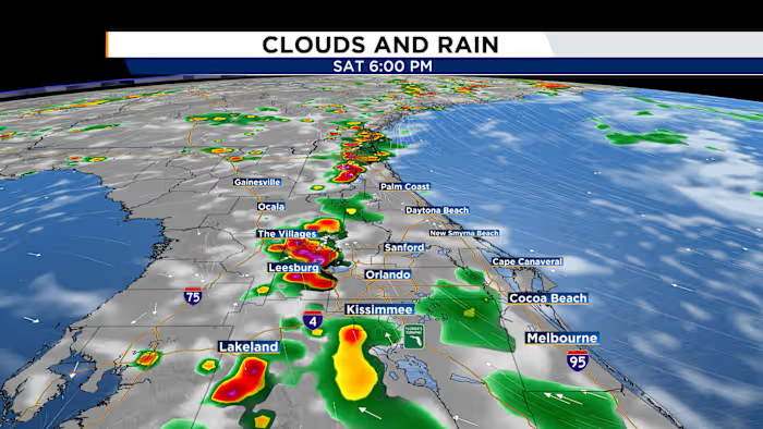
Central Florida’s Saturday weather will once again be shaped by the sea breeze, but higher moisture in the atmosphere means storms should be more widespread than a standard summer setup. The day will begin mostly dry, with intervals of sunshine and clouds, before temperatures climb quickly into the 90s and heat index values approach 100 degrees. Around midday, showers and thunderstorms are expected to develop near both the I-95 and I-75 corridors as the east and west coast sea breezes take shape. Those boundaries will push inland through the afternoon and are forecast to meet near and just west of I-4 between about 3 and 4 p.m. That collision zone will likely spark a surge of storms around the Orlando metro area and along the I-4 corridor during the second half of the day. Because winds higher up in the atmosphere will be very weak, storms may move slowly, raising the risk for pockets of localized flooding, especially in poor drainage and low-lying areas. Rain and storms will continue to drift across Central Florida into the evening before gradually winding down around 8 to 9 p.m.
Sunday
On Sunday, high pressure will build over Florida, helping the atmosphere become a bit more stable. That should limit the intensity and coverage of the sea breeze storms compared with Saturday. Expect a more typical Central Florida summer pattern, with scattered showers and storms developing along the sea breeze shortly after lunch and continuing into the mid-afternoon. Afternoon highs will reach the low to mid-90s.

The News 6 Weather team keeps you prepared and informed with the latest Central Florida forecast.