

ORLANDO, Fla. – A cold front moving south across Central Florida is ushering in a much drier air mass, setting the stage for the coolest mornings the region has experienced in months by this weekend.
A few isolated showers developed Thursday morning, but rain chances will gradually fade as the dry air advances southward. A passing shower remains possible at a 20% to 30% rate, while afternoon temperatures climb into the mid and upper 80s.
The most noticeable shift will be in the humidity. Drier conditions are already filtering into Central Florida behind the front, and the change should become especially apparent Friday and throughout the weekend.
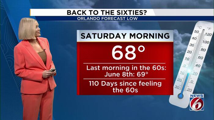
Saturday morning will bring temperatures in the 60s to much of the area, including a projected low in the upper 60s at Orlando International Airport. The last time MCO fell below 70 degrees was June 8, when the temperature bottomed out at 69. By Saturday, roughly 110 days will have passed since Orlando last experienced a morning in the 60s.
Morning temperatures are expected to stay in the 60s through the weekend, followed by afternoon highs mostly in the 80s. Lower humidity will make the start and end of each day feel considerably more comfortable.
Gusty winds and St. Johns River concerns
The front is also strengthening winds from the north and northeast. Gusts may reach 30 to 35 mph Thursday, particularly near the coast, with blustery conditions continuing Friday and into at least the first part of the weekend.
The steady northerly flow is affecting water levels along the St. Johns River near Astor. The river is currently at Action Stage and is expected to reach Minor Flood Stage Thursday evening. The rise is not the result of new rainfall; strong winds from the north can restrict or even reverse the river’s flow, causing levels to increase. Minor flooding may persist through at least the weekend.
Beach and offshore conditions are expected to remain hazardous. Powerful winds will contribute to rough surf, stronger longshore currents and a heightened risk of rip currents. Anyone heading to the beach should remain especially cautious, even with more pleasant weather arriving this weekend.
Fay regains tropical storm strength
In the Atlantic, Fay has strengthened back into a tropical storm. The latest National Hurricane Center advisory listed maximum sustained winds of 40 mph, with the system moving west-southwest at 9 mph. Fay was located well away from land, approximately 935 miles west-southwest of the Azores, and no coastal watches or warnings were active. Little change is expected over the next day or two before the storm gradually weakens. Fay poses no threat to Florida.