
A powerful hurricane is racing toward Mexico while Southern California prepares for hazardous surf, intense rip currents and coastal flooding. The storm’s vast swells are expected to hit beaches throughout the region.
The National Oceanic and Atmospheric Administration says Hurricane Polo could make landfall in Baja California Sur on Monday, after rapidly intensifying into one of the strongest storms ever observed in the eastern Pacific.
Polo is not projected to strike Southern California directly. However, its enormous wave energy is expected to travel north, with the worst coastal conditions forecast for Monday and Tuesday.
The first swells may reach the coast late Sunday. High tides approaching 7 feet could increase the risk of flooding on beaches, coastal paths and other low-lying areas.
The National Weather Service cautioned that Los Angeles and Ventura counties could face surf reaching four to seven feet, dangerous rip currents, beach erosion and possible flooding as the swell arrives near high tide.
Forecasters are particularly concerned about the Long Beach Peninsula, Belmont Shore, Malibu and Avalon. Still, hazardous conditions could develop along much of the Southern California coastline.
The region’s beaches are still recovering from Hurricane Marie, which battered the coastline earlier this month with powerful swells, king tides and dangerous surf that caused extensive erosion and infrastructure damage.
Long Beach, Malibu and other coastal communities experienced flooding, damaged seawalls and severe beach erosion. The resulting vulnerabilities remain as residents and officials continue responding to the earlier storm.
Crews in Long Beach and Seal Beach have been reinforcing sand berms and making preparations for possible flooding.
In Seal Beach, lifeguard towers were removed from sections of the shoreline after erosion left too little safe beach space for the equipment.
Long Beach officials are also strengthening the sand berm that shields homes along the peninsula while staging sandbags and pumps ahead of the incoming swell.
“The main concern with this particular system is the significant wave energy, very dangerous surf, significant and potentially dangerous to deadly rip currents will also be occurring,” NOAA’s Dr. Ariel Cohen told KTLA.
The threat has also prompted wildlife officials to move two recently discovered olive ridley sea turtle nests from Seal Beach and Huntington Beach to the Aquarium of the Pacific in Long Beach. Officials cited the combination of high tides and dangerous surf.
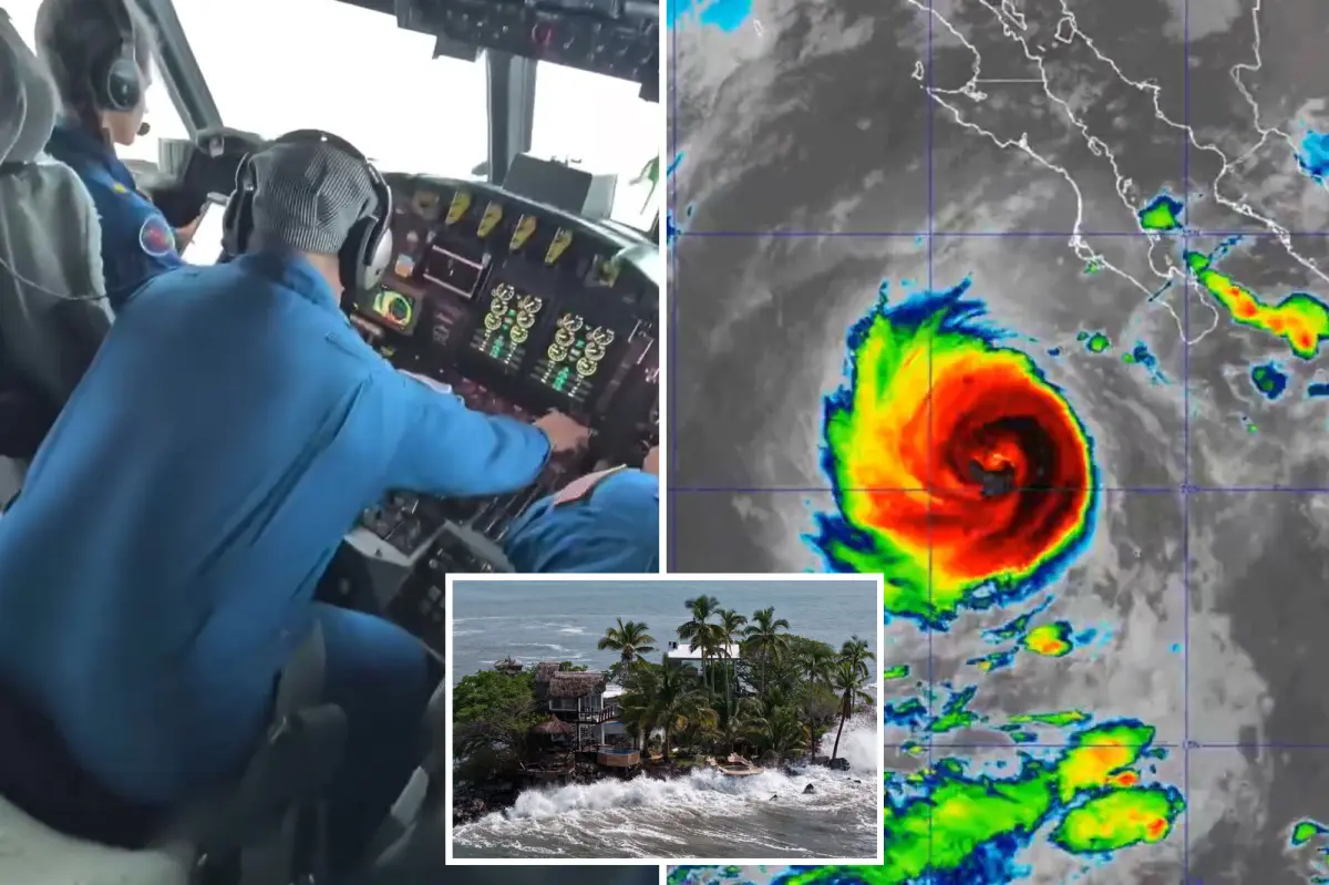
At the same time, striking footage from inside Polo offers a glimpse of the hurricane’s extraordinary strength.
Video released by NOAA’s Hurricane Hunters shows a WP-3D aircraft flying directly through Polo’s powerful eyewall.
The aircraft shakes and jolts violently in the cockpit as the crew heads toward the eye. Once they reach it, the turbulent flight suddenly gives way to an unsettling calm.
A second perspective from the flight captures blue skies encircled by towering white clouds as the aircraft emerges within the hurricane’s eye.
Polo previously intensified to an extraordinary 180 mph, while its central pressure fell to roughly 892 millibars—putting the storm among the most powerful eastern Pacific hurricanes ever recorded.