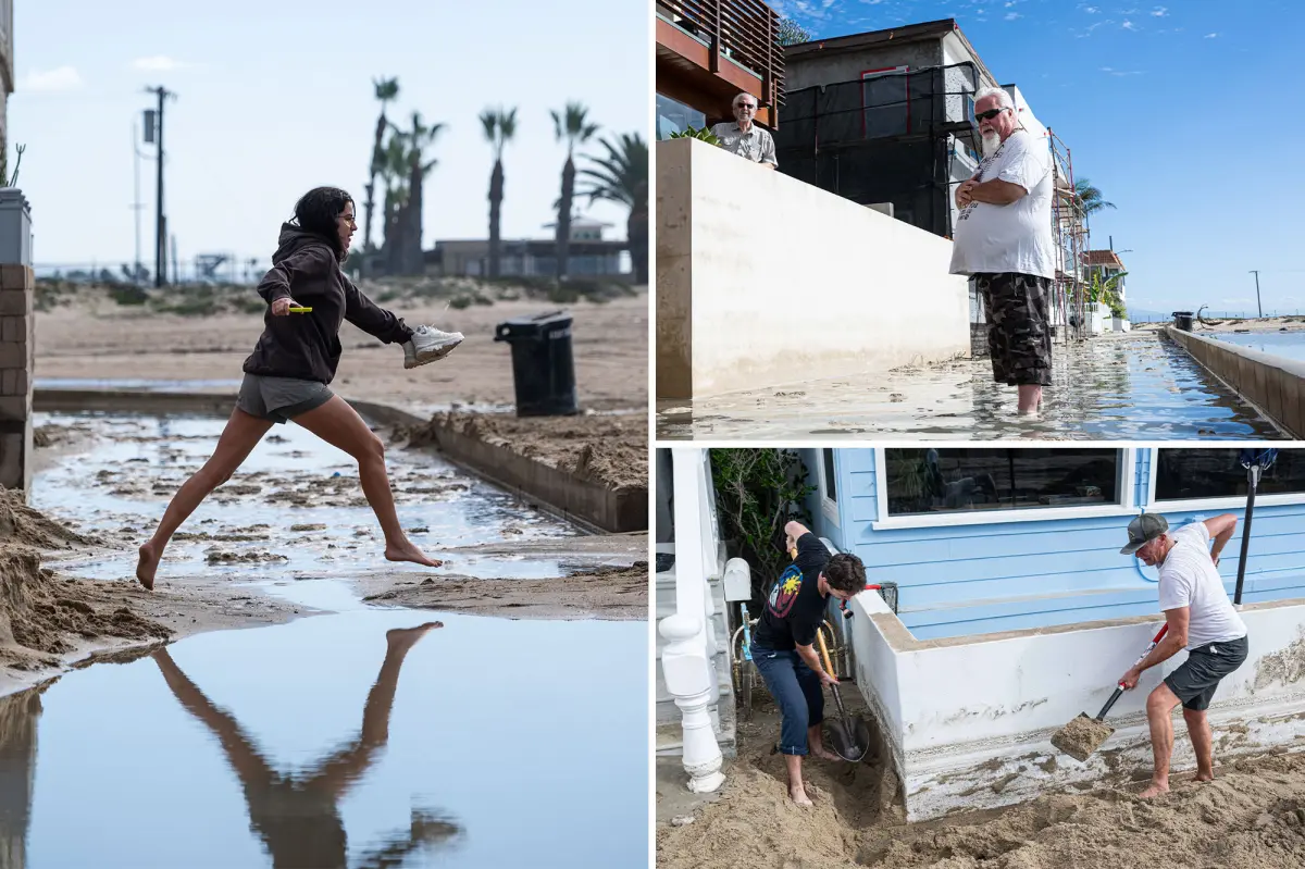

A powerful El Niño storm has pounded Seal Beach, sending waves over sand barriers and into the vicinity of multimillion-dollar homes along the Orange County shoreline. Residents are now facing extensive cleanup as officials prepare for more dangerous conditions.
The surge struck the affluent coastal community despite a major pre-storm effort by city crews to reinforce its defenses and limit the risk of flooding.
Large waves repeatedly slammed into the protective sand berms and spilled across them, prompting concern that additional flooding could occur when another cycle of exceptionally high tides arrives.
Before the storm moved in, workers had strengthened the berms, checked drainage infrastructure and positioned equipment and staff to respond to possible flooding.
Seal Beach’s Public Works Department had also cleared storm drains and inspected pumping systems ahead of the expected surge.
Despite those preparations, the ocean breached portions of the sand defenses, underscoring how exposed homes located only steps from the water remain during major coastal storms.
City officials are warning residents that the threat may continue, with unusually high “king tides” forecast during Thanksgiving week, from Nov. 22 to Nov. 27.
Homeowners have been advised to bring in or secure outdoor items, keep drainage paths clear and place sandbags at vulnerable doors and entryways.
Free sandbags can be collected at several sites, including Marina Park and area fire stations.
Seal Beach is not the only California coastal community facing the storm’s effects.
To the south, a troubling crack has appeared in a seaside bluff below one of the state’s most exclusive resorts, raising concerns that additional rain and surf could cause part of the slope to collapse onto a popular trail.
The fracture is located beneath The Ritz-Carlton, Laguna Niguel, in Dana Point, directly above the busy Salt Creek Point trail. Hundreds of beachgoers, pedestrians and surfers use the route each day.
Craig Whetter, a local videographer with Breaking Even TV, recorded the fissure last week. His footage shows a distinct split running through the bluff above Salt Creek Beach.
“There is a new crack in town, ladies and gentlemen, and it lives right above that Salt Creek Point trail,” Whetter said in the video. “It’s right above a very, very popular walkway that people use all day … it’s putting a lot of people in danger.”
Further rain and heavy surf could accelerate the damage. Water entering the crack may saturate the soil, while relentless waves continue eating away at the base of the bluff.
The trail below leads to several well-known surf breaks, including the Point, Middles and Gravels.
Authorities have not released a geological evaluation showing how deep the fracture extends or indicating whether the luxury resort above is facing an immediate structural danger.
The fissure is the latest in a series of warning signs along California’s increasingly vulnerable coastline.
In October, a fissure measuring about 360 feet long and 2 feet wide opened beneath Pacific Coast Highway near El Morro at Crystal Cove State Park.
The damage led to southbound lane closures and a $4 million emergency stabilization effort. Crews used massive sandbags and tarps to help protect historic beach cottages below the highway.
Long Beach also reported substantial property damage in October, when powerful waves and high surf driven by major Pacific storms and the effects of Tropical Storm Rachel battered the Long Beach Peninsula.
As California prepares for a potentially historic El Niño winter, coastal communities are bracing for more severe surf, shoreline erosion and flooding in the months ahead.


