
Share this @internewscast.com

ORLANDO, Fla. – Monday has been marked as a Weather Alert Day by the News 6 Weather Team.
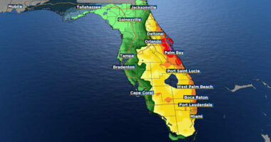
Central Florida is bracing for potentially severe weather as the Storm Prediction Center has placed the area under a Level 2 Slight Risk. This is due to a robust cold front sweeping southward through the state.
As this front nears, there’s an 80 percent chance of rain on Monday. The most significant threats from the storms include wind gusts reaching up to 60 mph, frequent lightning, torrential downpours, and hail. Although the chance of tornadoes is minimal, it’s not entirely absent.
The day will begin quietly with some sunshine and temperatures rising swiftly. It will also be breezy ahead of the front, with winds from the south-southwest possibly gusting up to 25 mph.
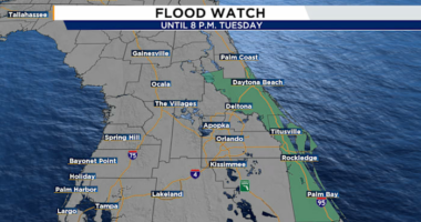
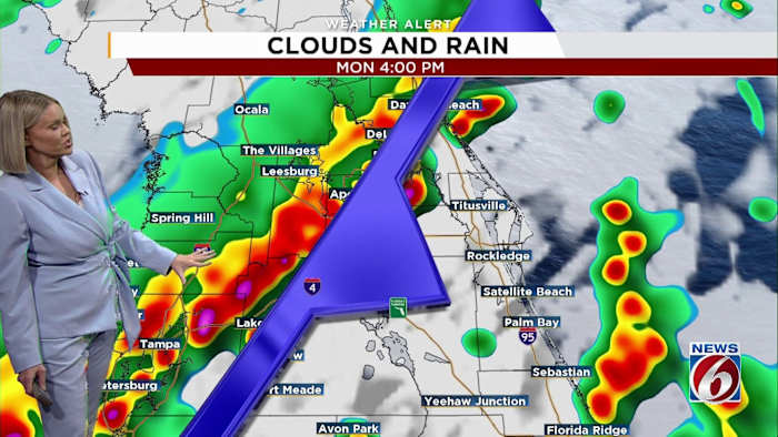
Storm activity is expected to start in northern Marion County around noon to 1 p.m. By 2 to 3 p.m., more intense storms will likely hit regions such as The Villages and southern Lake County.
The I-4 corridor is predicted to experience some of the fiercest storms between 3 p.m. and 6 p.m. Subsequently, from 6 p.m. to 9 p.m., the storm line will proceed into northern Brevard County before moving offshore, eventually clearing the area.
Behind the front, winds shift to the northwest, bringing in much cooler air.
Highs today will reach the 80s across much of the area before the cooler air arrives tonight. By Tuesday morning, temperatures will feel much colder across parts of Central Florida.
Highs on Tuesday will only reach around 60 degrees before a gradual warming trend begins later in the week. By the weekend, temperatures climb back into the low 80s.
You can stay up to date on storms and warnings in your area by downloading the free News 6 Weather app. Just search WKMG in your app store.
Copyright 2026 by WKMG ClickOrlando – All rights reserved.