

ORLANDO, Fla. — Central Florida saw another sweltering Saturday, with afternoon highs reaching the mid-90s and heat index values climbing above 100 degrees. Conditions stayed mostly dry for much of the day, though a few isolated storms developed. Additional storms could pop up through the early evening before fading around 10 p.m., followed by partly cloudy and dry weather overnight.
Sunday is expected to bring much of the same, although storm coverage should be a bit more widespread by the afternoon. The day will start dry with a mix of sunshine and clouds, and a light west-southwest breeze will help temperatures rise back into the mid-90s. Humidity will again make it feel hotter, with apparent temperatures ranging from 100 to 105 degrees.
Storms are forecast to begin developing around 2 p.m. Thanks to a stronger westerly steering flow, those storms are likely to drift back toward the east coast through the latter half of the afternoon and into the early evening.
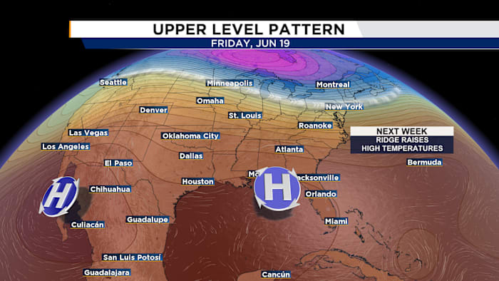
Heat is expected to intensify through the upcoming workweek as a ridge of high pressure strengthens over Florida in the middle and upper levels of the atmosphere. That setup will promote sinking, warming air across Central Florida, a pattern that typically reduces rain chances while pushing temperatures higher.
By the end of the week and into next weekend, highs could reach the mid to upper 90s, with heat index values soaring well above 100 degrees.