
Share this @internewscast.com
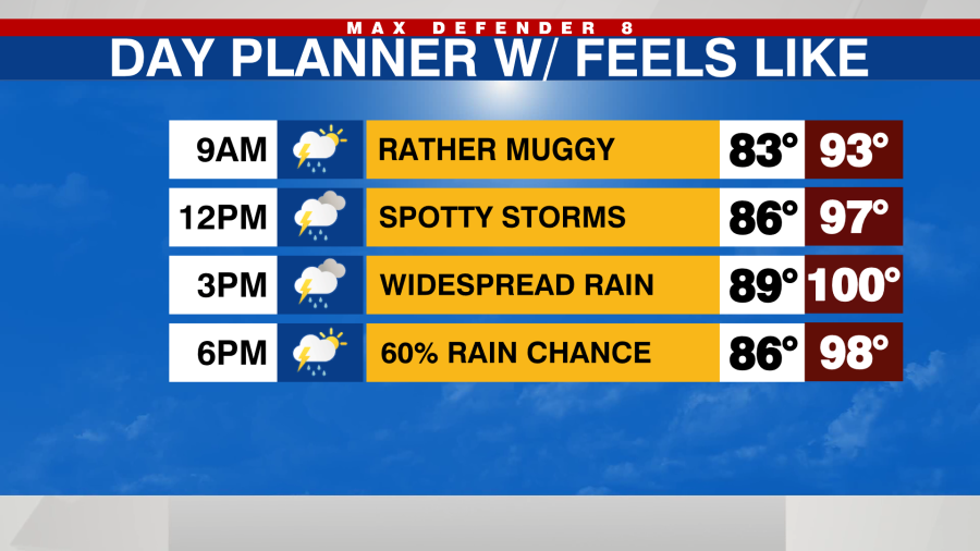
Deep tropical moisture is set to move across the state today and tomorrow, causing an increase in rain chances. This influx of clouds and rain will result in cooler temperatures, with highs staying in the upper 80s to near 90, but the humidity will still make it feel quite muggy.

Today’s rain chances will rise to 70%, leading to widespread showers and thunderstorms, particularly in the afternoon and evening hours. There will be occasional breaks in the rain, but tomorrow the rain chances will remain elevated at 60%.
Brief localized flooding is possible with some of the slower moving downpours.

There will still be showers and storms Friday afternoon and evening pushing toward the coast but the coverage of rain will be a lot lower.
By the weekend, drier air is expected to reduce rain chances significantly to just 20 to 30% each afternoon. With the decrease in rain, temperatures will soar over the weekend, with highs reaching between 94 and 96°, and heat index values climbing back to around 110°.

Rain chances will increase once again next week.

The National Hurricane Center is currently highlighting the tropical moisture crossing the state for possible tropical development once it moves away from the Tampa Bay area and into the Gulf.

The chance of development is low, just a 10% as of Wednesday morning, and the Tampa Bay area impacts will remain the same with widespread downpours Wednesday and Thursday.