

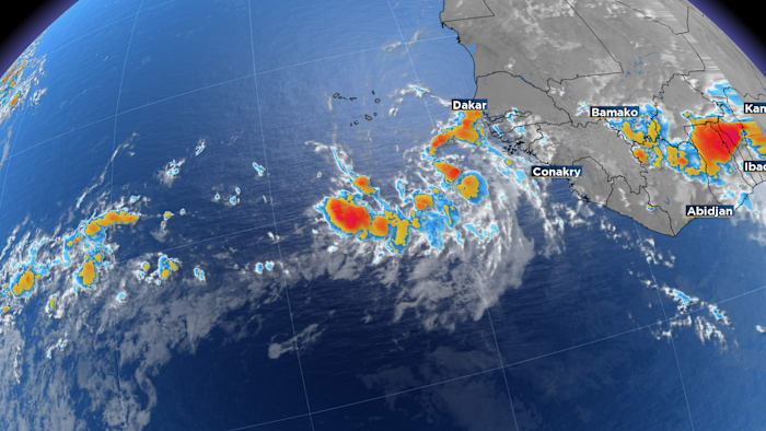
ORLANDO, Fla. – A strong tropical wave moved off the coast of Africa earlier Monday, drawing attention from forecasters. After the National Hurricane Center designated the disturbance as an invest, specialized tropical forecast models began running on the system.
The first set of model guidance released Monday evening generally pointed to a west-northwest track toward the central Atlantic.
Beyond that, longer-range forecasts begin to split on what could happen with Invest 96L. One scenario keeps the system weaker as it tracks near the Caribbean islands, while another allows it to become stronger and turn northward out to sea.
For Florida and the rest of the U.S., current signals suggest another weather system should be moving off the East Coast in time to help steer the disturbance away from land and out over the open Atlantic.
However, that part of the forecast remains well into the future and could still change.
In the near term, development is expected to be slow. Dry air and a relatively stable atmosphere should limit how quickly the disturbance can organize.
If the system holds together and eventually reaches the area between Puerto Rico and Bermuda, conditions may become more favorable for strengthening.
As of now, the National Hurricane Center gives the disturbance a 60% chance of developing over the next seven days.
Another disturbance Invest 95 L is hanging out near Bermuda. This entity has 50% chance for development over the next 7 days. The window will likely close quickly for this disturbance as it gets absorbed by another weather system moving off of the Northeast U.S.
The next named storm of the 2026 hurricane season is Dolly.