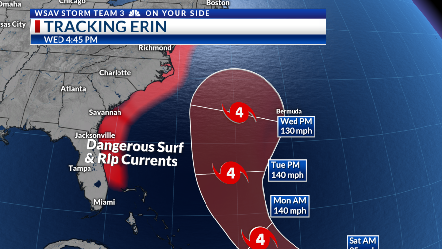
Hurricane Erin is projected to travel over 500 miles east of the Coastal Empire and Lowcountry, yet caution is still advised if you plan to be at the beach next week.
The National Hurricane Center’s forecast indicates that Erin’s core and its primary effects will remain offshore, away from our coastlines. The forecast cone represents both the predicted path of the hurricane’s center and the typical forecast errors.

All computer models uniformly predict the storm’s movement northward past the Southeast Coast. Additionally, they concur that Erin will become a large, significant hurricane while staying offshore.
The expansive area of strong winds will generate a wide expanse of waves that will reach the coastline.

Beach conditions should be pleasant this weekend with calm local winds and minimal wave activity. The risk of rip currents will remain very low on both Saturday and Sunday.
Beginning Monday and continuing through much of next week, waves from Hurricane Erin will reach the shores of the Coastal Empire and Lowcountry.

However, on Monday afternoon, expect waves of three to five feet at our beaches. From Tuesday through Thursday, waves could reach beyond five feet and even approach eight feet in some areas. By Friday, the surf will begin to subside, with anticipated waves of three to five feet.
The risk of rip currents will be elevated all week. Be aware of your swimming capabilities and follow all lifeguard instructions. If the beach is closed, avoid entering the water. Surfers may still surf, but swimming is discouraged for beach visitors next week.


Beach erosion concerns will come into play for some vulnerable locations. Waves will erode away portions of the beach and higher waves may run up to the dune line. Steer clear of large cuts in the beach as unstable sand can collapse at any time.
While the Coastal Empire and Lowcountry are avoiding the impacts of Hurricane Erin, it is important to keep an eye on the forecast as surf conditions are expected to be dangerous.