
Share this @internewscast.com

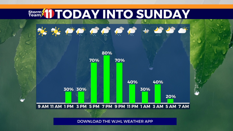
The Storm Team 11 Forecast calls for an 80% chance of scattered showers and thunderstorms mainly towards the evening hours on Saturday.
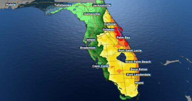
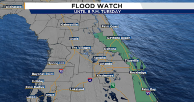
There is a chance for isolated strong to severe thunderstorms this evening. The potential threats include damaging winds reaching up to 60 mph, hail measuring an inch in diameter, and localized flash flooding. The expected high is around 74 degrees.
Scattered showers and a few thunderstorms will continue tonight with a low of 53 degrees. The chance of rain will be 60%.
On Sunday, there is a 50% chance of scattered showers and a few thunderstorms in the late afternoon. The high is projected to be 69 degrees. Showers are expected to taper off after sunset, leaving mostly cloudy skies. The low will be 53 degrees.
The influence of a cut-off low will maintain a 30% chance of scattered showers on Monday, particularly in the afternoon and evening. The high is forecasted to reach 67 degrees. There might be a few passing clouds Monday night, with a low dropping to 45 degrees.
Mostly sunny skies are on tap Tuesday as the upper-level low finally pulls away from the area. The high will be 70 degrees. Tuesday night will be partly cloudy with a low of 49 degrees.
Wednesday scattered showers will return to the area, mainly for Tennessee, with a mix of sun and clouds. The high will be 72 degrees with a 40% chance of rain. Scattered showers will continue late Wednesday night with a low of 54 degrees.
Scattered showers and a few thunderstorms will continue into Thursday morning, with additional showers likely into the afternoon and evening. The high will be 76 degrees with a 60% chance of rain.
Next Friday will feature drier weather with a mix of sun and clouds. The high will be near 72 degrees.