
Share this @internewscast.com

A formidable super typhoon in the Pacific Ocean is rapidly advancing toward a cluster of secluded U.S. islands.
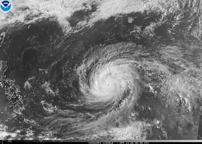
Super Typhoon Sinlaku is predicted to strike the Northern Mariana Islands on Tuesday, bringing with it fierce winds, extensive heavy rainfall, and potential flooding, as reported by the National Weather Service on Monday.
Guam, a U.S. territory housing American military bases, is also at risk of experiencing harsh winds beginning Monday and is currently under a tropical storm warning. Over the weekend, the U.S. Coast Guard issued alerts for potential flooding and high winds.
This tropical typhoon, the most powerful recorded globally this year, was generating sustained winds of 173 mph (278 kph) on Monday as it approached the islands of Rota, Tinian, and Saipan, according to the Joint Typhoon Warning Center.
Although a slight weakening is anticipated in the coming days, Sinlaku is expected to pass near the islands maintaining its strength as a Category 4 or 5 typhoon.
In Guam, where Typhoon Mawar previously caused prolonged power outages in 2023, U.S. military officials have advised personnel to brace for the storm and remain sheltered.
President Donald Trump on Saturday approved emergency disaster declarations for Guam and the Northern Mariana Islands, allowing for additional help with emergency services.
A super typhoon is a name given to the strongest tropical cyclones that brew in the northwestern Pacific Ocean, where Earth’s most intense storms usually form.
Monitored by the Joint Typhoon Warning Center in Guam, super typhoons are the equivalent of category 4 or 5 hurricanes in the Atlantic, with winds of at least 150 mph (240 kph). There have been more than 300 super typhoons identified since the warning center started using that name in 1947.
Copyright 2026 The Associated Press. All rights reserved. This material may not be published, broadcast, rewritten or redistributed without permission.