

ORLANDO, Fla. – Tonight, a few scattered showers might linger, with temperatures remaining in the 70s. The best chances for rain and thunderstorms, ranging from 30% to 40%, are anticipated to occur inland during the afternoon, particularly to the west of I-95 where the sea breeze boundary meets. Any storms that develop may bring gusty winds, frequent lightning, and brief heavy rainfall before tapering off later in the evening.
HOLIDAY WEEKEND
The weather forecast remains consistent as we approach Memorial Day weekend and continue into early next week. Expect the usual late-May Florida pattern with warm afternoons, humid nights, and scattered thunderstorms influenced by sea breezes each day. This weekend, rain chances will slightly increase due to rising moisture levels, resulting in more widespread inland storms during the afternoon and evening, with a 40% to 50% likelihood.
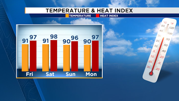
The primary concerns will be heat and humidity. Afternoon temperatures are expected to stay near 90 degrees, but the increasing humidity could push the heat index into the upper 90s and low 100s during the peak afternoon hours.
LATE WEEK
As we look toward late next week, some weather models hint at a potentially wetter pattern emerging. However, confidence in this forecast is low at this early stage.