
Share this @internewscast.com

ORLANDO, Fla. – Today, a pocket of dry air will move in, resulting in a moderate decrease in rain chances to about 40–50%. Nevertheless, both the east and west coast sea breezes will activate, bringing scattered showers and storms throughout the day.
A few of these storms could bring heavy downpours and gusty winds between 20–30 mph.
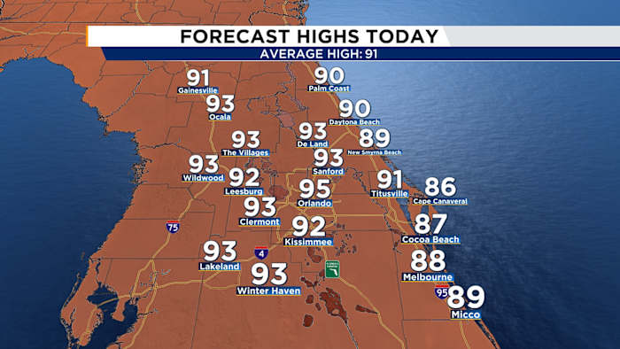
Afternoon highs will soar into the low to mid 90s, but it’ll feel more like 100–107 degrees!
[EXCLUSIVE: Become a News 6 Insider (it’s FREE) | PINIT! Share your photos]
With heat risks ranging from moderate to major, be sure to stay hydrated and take breaks if you’re spending time outdoors.
Tonight, expect scattered showers and storms to linger in a few spots.
Looking forward to Father’s Day on Sunday, expect a mainly dry start to the morning, although the likelihood of rain rises to 40% by the afternoon. Temperatures are expected to climb into the 90s once more.
As we move into next week, the weather appears slightly unstable with rain expected daily. Wednesday is predicted to be the hottest day, reaching a high of 96 degrees. Juneteenth will be hot and humid, with temperatures in the mid-90s, and as summer officially begins on Friday, it will definitely feel like summer.
Copyright 2025 by WKMG ClickOrlando – All rights reserved.