

ORLANDO, Fla. – Expect scattered thunderstorms to continue throughout Sunday evening, with a 30–40% chance of rain.
As night falls, temperatures are set to dip into the 60s and 70s, promising a warm and humid overnight experience.
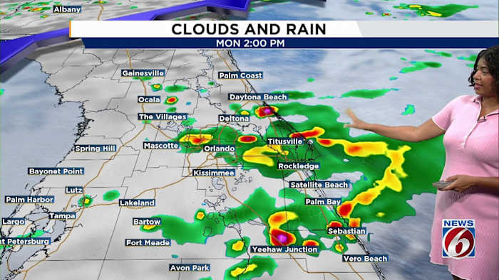
Come Monday morning, a few light showers may linger, but as sea breezes pick up strength throughout the day, they are likely to trigger more afternoon storms. The likelihood of rain will increase to 40–50% as the day progresses.
There’s a marginal risk that some of these storms could turn severe, posing threats such as damaging wind gusts, heavy rainfall, frequent lightning, and small hail. A brief tornado cannot be entirely ruled out.
Despite the storms, temperatures will remain high, reaching into the upper 80s and lower 90s.
Early Tuesday, a new cold front is expected to move in, bringing another batch of scattered showers and thunderstorms later in the day. High temperatures will hover in the mid-80s as the unsettled weather persists into Wednesday, offering much-needed rainfall. Following this, conditions will shift to hotter and drier, with temperatures climbing back into the lower 90s for the remainder of the week.