
Sunday: Stronger Wind Gusts, Higher Rain Chances
ORLANDO, Fla. – Sunday is expected to bring the weekend’s strongest winds and heaviest rain across Central Florida.
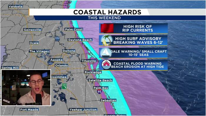
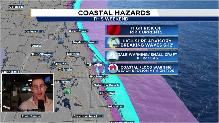
Northeast winds may run between 20 and 25 mph, with gusts reaching 35 to 45 mph. Multiple coastal alerts are in effect, including a Wind Advisory, Coastal Flood Warning, Small Craft Advisory, Gale Warning and High Surf Advisory. Waves could build to 6 to 12 feet near the beaches and 10 to 15 feet farther offshore.
High tide Sunday and again Monday morning could create especially serious coastal flooding concerns.
People are strongly urged to stay out of the ocean this weekend. Even a walk along the beach may be dangerous, particularly near high tide when powerful waves can surge well beyond the normal shoreline.
Rain chances will rise to roughly 40% west of the 95 corridor and as high as 60% along the coast. The Weather Prediction Center has placed much of the coastal region under a Level 1 of 4 risk for excessive rainfall. Periods of repeated showers may lead to isolated flooding, especially if heavier rain bands track over the same locations.
Next Week: Still Breezy, but Fewer Showers
Strong northeast winds will remain in place through Monday, with a few fast-moving showers possible, mainly near the coast.
Rain chances should gradually fall during the week, though occasional coastal showers cannot be ruled out.
Afternoon temperatures are expected to stay near 80 degrees each day, leaving much of Central Florida cooler than typical for late October.
Conditions inland should improve, but dangerous surf and rough boating conditions may persist into next week. Continued northeast winds will keep pushing water toward the coastline, prolonging the risk of beach erosion and coastal flooding.