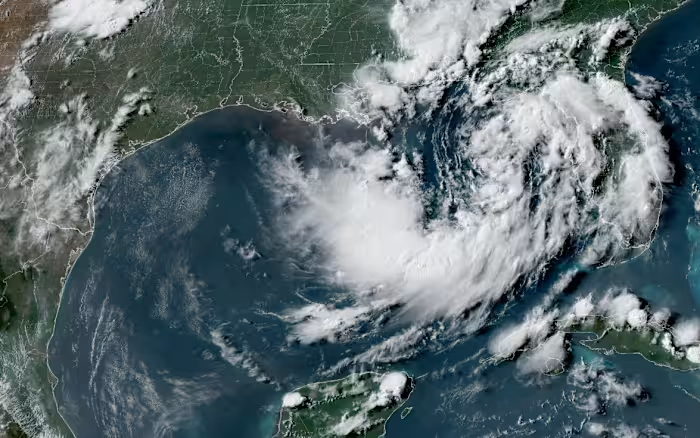


NEW ORLEANS – A slow-moving tropical depression meandering over the northern Gulf of Mexico is forecast to gain strength later Monday, bringing the threat of heavy rain, flooding and damaging winds to parts of the Gulf Coast this week. Forecasters warned that gusts could be strong enough to knock down trees and power lines in several states.
As of the latest update, the system was located about 110 miles (180 kilometers) south of Panama City, Florida, with maximum sustained winds near 35 mph (55 kph). The U.S. National Hurricane Center said the depression was expected to organize further and could become a tropical storm later in the day.
The Miami-based hurricane center said the disturbance was crawling generally northwest at about 3 mph (6 kph). Over the next several days, it is expected to track near or along the northern Gulf Coast, leading officials to issue a storm surge watch from the mouth of the Mississippi River eastward to the Alabama-Florida line.
A tropical storm watch was also in effect from Florida’s Ochlockonee River west to southeastern Louisiana, ending at the Jefferson and Plaquemines parish line.
The National Weather Service office in New Orleans said tropical storm conditions could begin spreading from the Florida Panhandle west into Louisiana by Tuesday. Forecasters cautioned that wind gusts may reach 40 mph (60 kph) and highlighted the potential for a “life threatening” storm surge along the coasts of Alabama, Mississippi and southeastern Louisiana.
According to the hurricane center, storm surge levels could climb as high as four feet (1.2 meters) in parts of coastal Louisiana and Mississippi. The agency also said one or two isolated tornadoes could develop over Florida’s Big Bend region as the unsettled weather spreads inland this week.
Flash flooding will remain a concern through Friday along a broad stretch of the Gulf Coast, from western Florida to central Texas, the weather service said. Rainfall totals could reach 3 to 5 inches (7 to 12 centimeters) along the Louisiana coast, with even higher amounts possible in some locations, especially south of Lake Pontchartrain.