
Millions of people along Australia’s east coast should keep their brollies handy this week as a prolonged drenching begins.
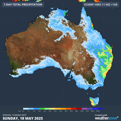
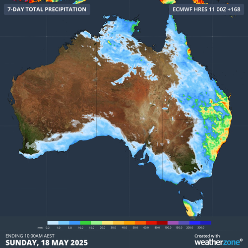
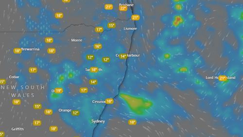
Forecasters say falls of 30mm to 70mm are expected along the coastal fringes of NSW and Queensland, but some isolated areas may record up to 100mm.
Due to unstable weather conditions, the Bureau of Meteorology has issued a hazardous surf warning for the waters along the K’gari coast, Sunshine Coast, and Gold Coast.
As we look forward, rain is expected to extend from the South Coast of NSW to the northern goldfields of Queensland, with predictions indicating the heaviest downpour on Thursday and Friday.
There will also be the likelihood of thunderstorms in southern Queensland and north-east NSW on those days.
Relief from the stormy conditions is expected by Saturday when the low-pressure system moves east towards New Zealand.
But it may only be brief because forecasters say there is the chance of a new trough building bringing more wet weather to the east coast.