Share this @internewscast.com
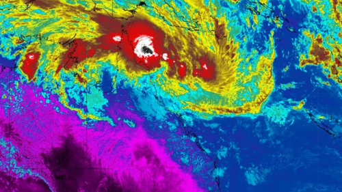
Tropical Low 12U is approaching the region with a 60% likelihood of evolving into a cyclone.
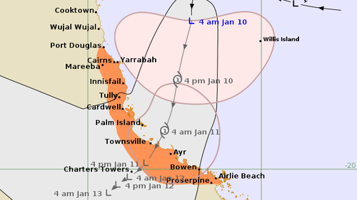
According to Dean Narramore from the Bureau of Meteorology, even though the system is situated a few hundred kilometers northeast of Cairns, its presence is already making an impact.
“We’ve noticed an increase in rainfall well to the south, particularly around the Mackay-Central Coast area, where there’s been significant rain development,” he mentioned on Today.
“This rain is expected to continue spreading northward throughout today and tonight as the low-pressure system moves closer,” Narramore added.
The Bureau predicts “widespread rainfall” by tonight and into tomorrow, with expected amounts ranging from 100mm to 200mm, and isolated areas potentially seeing up to 400mm.
Wind speeds are also anticipated to intensify, with gusts reaching between 80 km/h and 100 km/h by tomorrow.
“The rain is of most concern because we still have a lot of flood warnings current between Cairns and around the Townsville area, and this additional rainfall is going to lead to further and widespread river level rises,” Narramore said.
The current warning zone covers Port Douglas to Airlie Beach, including Cairns, Innisfail, Townsville, Bowen, and Proserpine.
Complicating management of the weather event is a serious connectivity issue affecting the Townsville area.
A thief cut a telecommunications line while trying to steal copper in Deeragun.
“My message to that lowlife is you have put at risk the lives of North Queenslanders in their hour of need and you can’t get a lower act than that,” Premier David Crisafulli said.
“And we intend to make sure that we throw the book at this individual when they are caught.
“Telecommunications are life and death.”