
Britain was left shivering overnight as a sharp cold snap sent temperatures tumbling towards a bitter -7C.
The mercury fell to its lowest level of the year as the UK entered a “colder phase” of weather, the Met Office said.
Forecasters warned of a “very cold night” on Friday, followed by a frosty start to Saturday across England and Wales.
Temperatures dropped well below freezing in many parts of the UK, with a low of -6.6C recorded at Sennybridge in Wales.
The mercury also plunged to -6.5C in Shap, near Penrith in Cumbria, and at Eskdalemuir in Dumfries and Galloway.
More unsettled conditions are expected on Saturday, with brisk winds, heavy rain and showers moving in from the west across much of the UK.
Daytime temperatures are forecast to range from 5C in Norwich and Manchester to 11C in Plymouth.
Central and eastern England should remain largely dry, with clear spells and widespread, heavy frost.

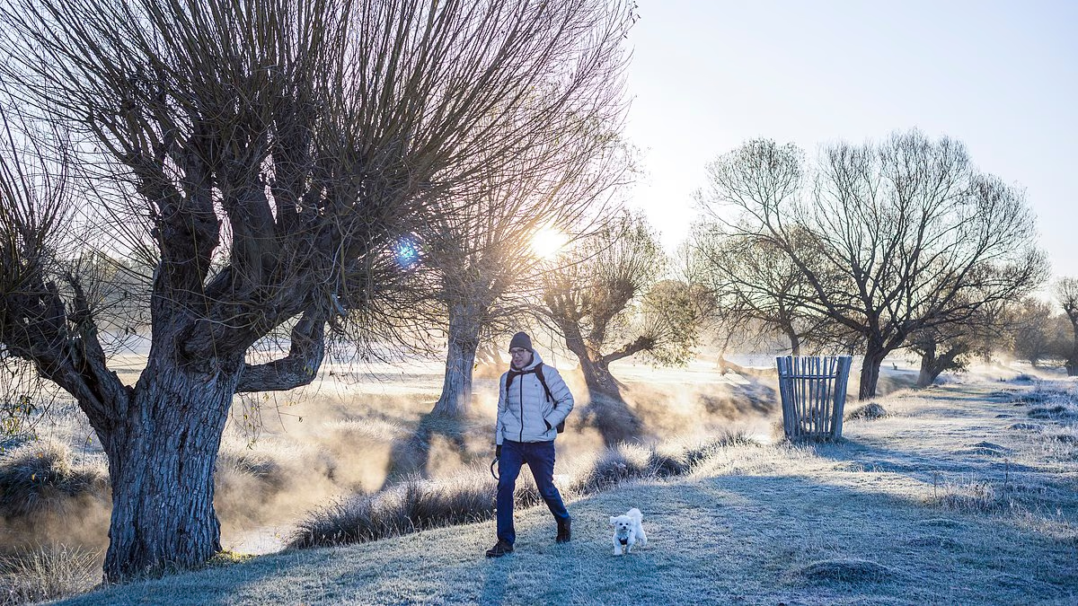
A walker makes his way through Richmond Park in south-west London on a frosty Friday morning

Visitors arrive at Avon Beach in Dorset yesterday before taking a chilly dip in the sea

Mist hangs above a river flowing through frost-covered Richmond Park on November 13

Frost coats car windscreens on a residential street in Wimbledon after temperatures plunged overnight

The first yellow cold-health alerts of the season were issued this week for the North West and West Midlands
Snow is also possible in north-west Scotland over the weekend, where cloudier skies have limited the spread of frost.
Met Office chief forecaster Chris Bulmer said: “The UK forecast has moved to a colder phase, with daytime temperatures in most locations likely to remain in single figures.
“Overnight temperatures on Friday will fall again to -4C or as low as -6C in some areas, bringing another significant ground frost for many locations.”
Friday saw the first widespread frost of autumn after the UK recorded its “coldest night of the season”, according to the Met Office.
The wintry conditions are expected to ease over the weekend, with milder air arriving and temperatures remaining above freezing on Sunday morning.
Sunny spells are expected in eastern areas during the morning, spreading to the far north and west later in the day.
Elsewhere, conditions will be cloudy and windy, with outbreaks of rain—some of them heavy—and the possibility of snow over northern hills.
Met Office deputy chief forecaster Steven Keates said: “The outlook is changeable, with spells of rain, sleet and some hill snow.

A man takes his dog for a brisk morning walk through a London park over the weekend

A paddleboarder braves the freezing water and weather in Dorset yesterday morning
“On Sunday, low pressure will bring rain or showers to many parts of the country.
“Rain is expected to be most persistent across northern Scotland, where the chance of snow developing will increase later in the day.
“Most of the snow will fall over higher ground, where accumulations are likely, although some could reach lower levels. Ice may also become a hazard.”
The UK Health Security Agency issued the first yellow cold-health alerts of the season this week for the West Midlands and North West.
The alerts came into force at 9am on Thursday and will remain in place until noon on Saturday.
The warnings indicate that the weather is “likely to have minor impacts on health and social care services”, including increased demand for healthcare and a greater risk to vulnerable people, the agency said.
Dr Anya Gopfert, a UKHSA consultant in public health, said: “This is the first cold-health alert of the winter, but we can expect more as we move further into the season.
“Cold weather can seriously affect some people, including those aged 65 and over and anyone with pre-existing health conditions. It is therefore vital to check on friends, family and neighbours who may be most vulnerable.”
Dr Gopfert said keeping homes heated and wearing warm clothing could help people stay safe during the cold spell.
Do YOU have a story? Email Joshua.Haining@dailymail.co.uk


