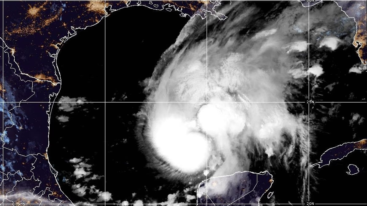

Mandatory evacuations have been ordered in parts of Florida as newly formed Hurricane Isaias threatens the US Gulf Coast with life-threatening flooding and damaging winds.
Isaias strengthened in the Gulf on Wednesday night, becoming the latest first hurricane of a season since satellite tracking began.
AccuWeather meteorologists forecast that the storm could reach Category 2 strength before making landfall along the US Gulf Coast late Friday evening or early Saturday morning.
A hurricane warning is in effect from Ocean Springs, Mississippi, across Alabama’s coastline to the Bay/Gulf county line in Florida. Storm surge could inundate some coastal areas with five to seven feet of water.
Evacuation orders have been issued for Florida’s Okaloosa and Gulf counties, while the rest of the Panhandle remains under a state of emergency. Alabama has also declared a state of emergency in counties along the Gulf Coast.
The National Weather Service (NWS) issued an urgent warning to the millions of people in Isaias’ path, urging them to complete evacuation plans before road conditions deteriorate.
“Leave immediately if evacuation orders are given for your area to avoid being cut off from emergency services or needlessly risk lives,” the agency said.

Isaias strengthened in the Gulf on Wednesday night and is expected to make landfall in the United States late Friday evening or early Saturday morning.

Forecast models show Isaias approaching the US coast on Friday, with landfall expected between Biloxi, Mississippi, and Panama City, Florida, from Friday evening into early Saturday.
AccuWeather’s forecast indicates that Isaias will move northeast across the Gulf on Thursday before turning north toward the US coastline on Friday.
The storm is expected to reach Category 1 hurricane strength by 8pm ET Thursday and intensify to Category 2 before making landfall near the Mississippi-Alabama border at around 11pm ET Friday.
If Isaias reaches land as a Category 2 hurricane, wind gusts of 100 to 120mph could strike areas near and just east of the storm’s center.
AccuWeather Chief Meteorologist Jon Porter warned: “However, because of the swift forward speed and broadening wind field of Isaias as the storm moves inland, damaging winds and power outages are likely to extend well inland.”
The NWS urged communities from Ocean Springs, Mississippi, to Gulf County, Florida, to prepare for the possibility of “long-duration power outages.”
Storm surges of up to seven feet are also expected near and east of Isaias’ center along the northern Gulf Coast, with communities in Mississippi and Florida’s Panhandle forecast to experience the greatest impacts.
AccuWeather meteorologists cautioned, however, that the storm’s most significant threat could come from heavy rainfall.
Isaias is forecast to bring three to seven inches of rain to the central Gulf Coast from Friday through the weekend. Isolated totals of up to 10 inches could trigger flash flooding.

Panic buying swept through states in Isaias’ path, with residents stocking up on toilet paper, water, bread and other supplies as store shelves emptied.

Gas stations were crowded with motorists preparing for the approaching storm.
Concerns over a potentially devastating storm have left shelves bare in towns and cities along the US Gulf Coast, as residents buy up supplies including toilet paper, water and canned food.
Images on social media show long lines at gas stations and depleted supermarket shelves.
Florida local Stephen Page posted on Facebook: ‘Stores are already run over, and shelves are empty at many places.
‘Lines at gas stations are long, and people are in full prep mode. So again, I say, if you haven’t started, now is the time!’
Another Floridian, Stephanie Michelle, said she experienced panic buying at the grocery store.

Based on Isaias making landfall as a Category 2, wind gusts of 100 to 120mph are forecast near and just east of the center
‘The store was full, the parking lot was full, shelves were empty, and the carts were all full! People were everywhere, and traffic was a nightmare,’ she added.
The Atlantic has yet to produce a hurricane in 2026, putting the season within reach of a record set in 1905 for the latest first hurricane.
If forecast models are correct and Isaias develops into a hurricane, it would be deemed a record-breaking storm.
Meteorologist Matt Devitt said on X: ‘Isaias will likely be one of the most significant storms of the 2026 Atlantic Hurricane Season with a landfall in the US.’