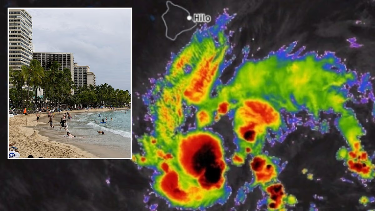

A rapidly strengthening tropical system in the Pacific is putting more than a million Americans on alert as Hawaii prepares for the possibility of a powerful hurricane.
Hawaii declared a statewide emergency Wednesday as forecasters warned that Tropical Storm Nolo could intensify into a Category 2 hurricane before approaching the Big Island.
The National Hurricane Center issued a tropical storm warning for the region Wednesday morning, when the system was still classified as Tropical Depression Fifteen-E.
A tropical depression marks the earliest stage of a tropical cyclone, developing when a low-pressure system produces thunderstorms and relatively weak winds. Once sustained winds reach 39 mph, the system is upgraded to a named tropical storm.
By Wednesday, Nolo was less than 400 miles from Hawaii’s Big Island, prompting officials to issue a hurricane watch that afternoon. Forecasters expect the storm to reach hurricane strength—with winds above 74 mph—by Thursday.
AccuWeather meteorologists said Nolo could bring heavy rain for at least three days. If the system slows or stalls near the islands, however, flooding and mudslides could intensify, with some areas receiving up to 18 inches of rain.
Hawaii Gov. Josh Green described the storm as “an imminent danger,” highlighting risks to the Big Island—also known as Hawaii Island—and Maui, one of the state’s most popular tourist destinations.
“This is a very serious situation, and we are urging people in Hawaii to take this threat seriously and prepare now,” AccuWeather expert meteorologist Nicholas Arman said in a statement.

A major storm has developed less than 400 miles from the Hawaiian Islands

Forecasters expect the system to become a named tropical cyclone by Wednesday night
The most intense rainfall is expected to reach the Big Island by Wednesday afternoon. The island has a reported population of more than 200,000.
AccuWeather Chief Meteorologist Jon Porter said the duration of the rainfall will depend on how quickly the storm moves. “If the storm keeps moving slowly along, we are looking at about three days of drenching rain focused on the Big Island,” he said.
“However, if the storm stalls, we could be looking at five or six days with persistent drenching rain,” Porter added.
As Nolo moves toward Hawaii, torrential downpours are expected to spread across the state’s other major islands.
Heavy rain and potentially dangerous flash-flood conditions are forecast across the entire state by Friday afternoon.
A stall near the islands could make flooding and mudslides significantly worse in vulnerable areas.
“Significant, damaging flooding and mudslides are possible, and lives could be at risk,” Arman said. “People should not wait until flooding begins to take action. They should begin preparing even though government watches and warnings have not yet been issued.”
Winds ranging from 40 to 80 mph could cause widespread property damage, particularly in parts of Hawaii that are still recovering from a deadly summer marked by repeated tropical cyclone threats in the Pacific.

Hawaii has declared a state of emergency as flood threats remain in place for the coming week

Rain is expected to begin September 23, with totals nearing 18 inches in some locations
Over the last two months, Hawaii has been severely impacted by hurricanes Lala and Lowell, which destroyed over 100 homes, damaged hundreds more and killed at least five people.
Acting Hawaii County Civil Defense Director Darryl Oliveira said that recovery efforts were still ongoing in the Big Island’s Kaʻū District after Lala hit the state on August 15.
Similar downpours, flooding and mudslides, as are predicted in Nolo’s forecast, led to more than 100 homes on the Big Island being washed away during the August hurricane.
Hurricane Lowell struck the opposite end of the island chain in September, causing widespread power outages and property damage on the islands of Kauaʻi and Niʻihau.


