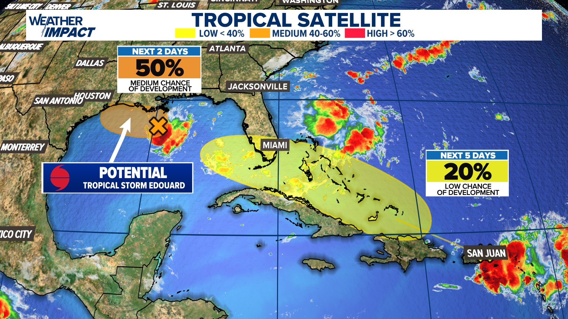

A developing weather system in the Gulf of Mexico may strengthen into Tropical Storm Edouard in the coming days, while what is left of Dolly edges nearer to Florida. Both features could produce rounds of heavy rain.
WASHINGTON — Attention is turning to the northern Gulf Coast, where a tropical disturbance known as Invest 97L is showing growing signs of organization and could become the next named storm of the Atlantic hurricane season.
Forecasters say the odds of development have climbed rapidly to 70%, though key details remain unclear, including where the system may come ashore and how much it might intensify before reaching land. Because the disturbance is still trying to organize, its eventual strength remains difficult to pin down.

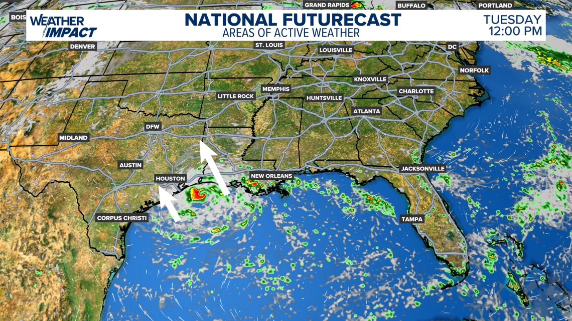
Should the system gain enough strength before moving inland, areas from Louisiana into southeast Texas could see episodes of heavy rainfall, gusty winds and a limited flooding concern Tuesday into Wednesday.
Even without full tropical storm development, deep tropical moisture tied to the Gulf disturbance may still create unsettled conditions and pockets of heavy rain along the northwestern Gulf Coast.
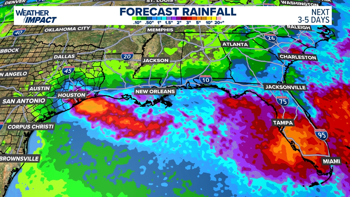
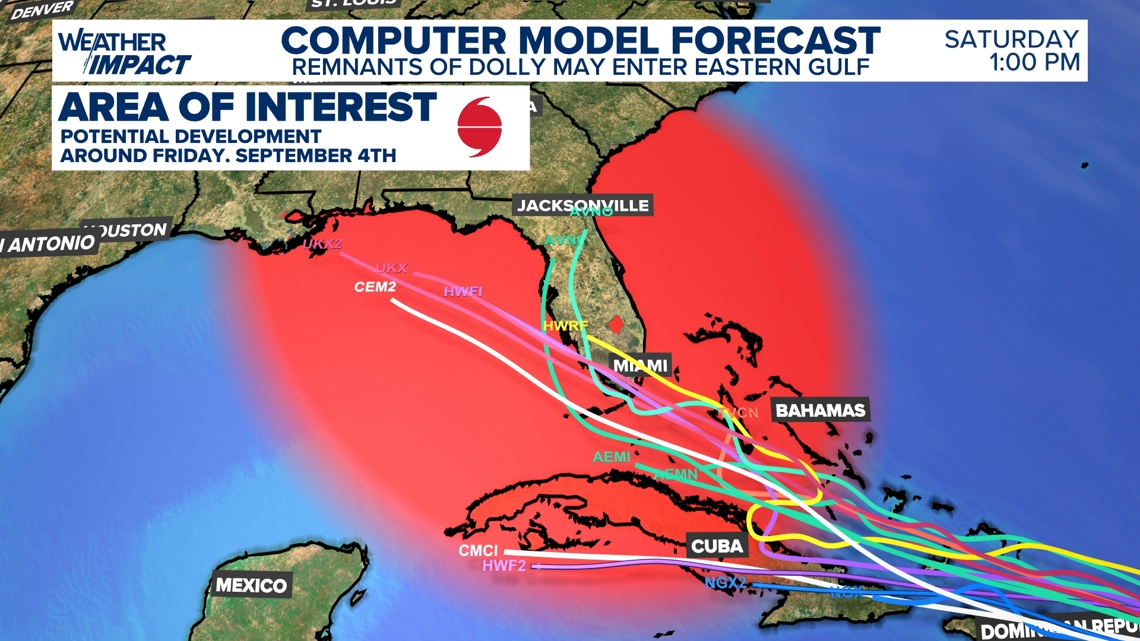
Farther east, meteorologists are also tracking another area of concern: the remnants of former Tropical Storm Dolly. That moisture is drifting toward Florida and could help fuel heavier downpours later this week.
For now, Dolly’s remnants remain poorly organized, but forecasters will monitor the system for possible redevelopment as it nears the eastern Gulf. Depending on its track and where the strongest rain bands set up, parts of Florida and nearby areas could face localized flooding concerns.
As is often the case with tropical weather, the outlook can shift quickly as conditions change.
Residents along the Gulf Coast should stay up to date with the latest forecast and check in with their local weather team each day for updated information on potential rainfall, flooding and wind impacts.