
Share this @internewscast.com

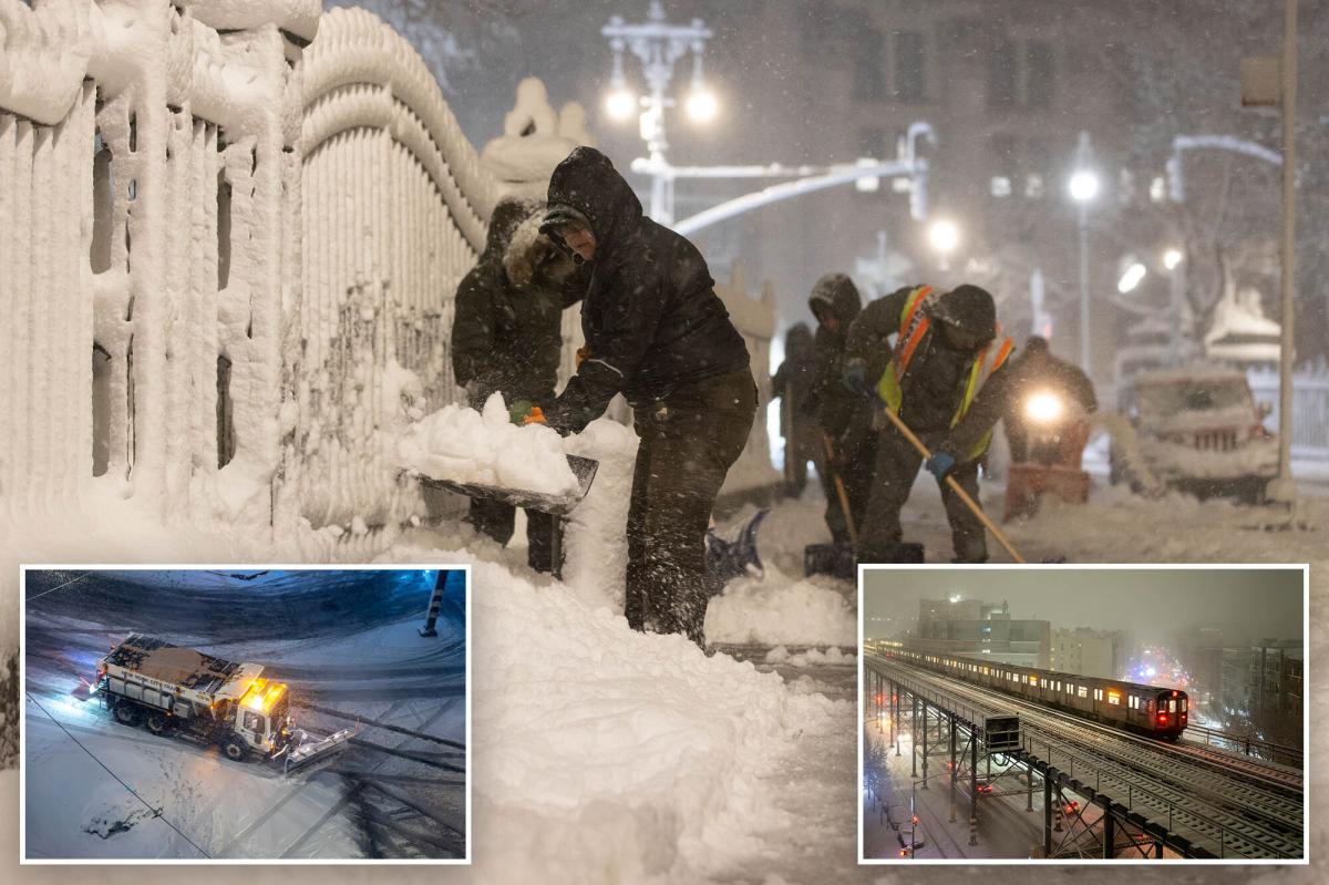
New York City ground to a halt on Monday morning as a powerful bomb cyclone unleashed a deluge of snow across the region, with more expected to accumulate throughout the day.
In the pre-dawn hours, the snow continued to fall intensely, with Staten Island already blanketed by over 13 inches. Mott Haven in the Bronx had received a foot, while Flatbush and Washington Heights reported over 11 inches, according to the latest figures from the National Weather Service.
In the heart of the storm’s path, Freehold in Monmouth County, New Jersey, was buried under an astounding 19 inches of snow, as reported by Fox Weather.
This historic storm is anticipated to continue its onslaught for most of the day, potentially leaving up to 20 inches of snow in some parts of the tri-state area before it finally moves on late Monday.
Accompanied by wind gusts reaching up to 60 miles per hour, the blizzard has caused power outages affecting more than 250,000 people along the East Coast, with over 100,000 of those in New Jersey.
In response, New York Governor Kathy Hochul has declared a state of emergency for all five boroughs, Long Island, and several other counties. Similarly, the entire state of New Jersey is under a state of emergency.
The streets of the Big Apple were eerily empty with the exception of snowplows as a travel ban was put in effect beginning Sunday at 9 p.m. and continuing through noon on Monday.
All NJ Transit services have been suspended and Long Island Railroad and NYC subways are also experiencing cancelations, delays and service changes, according to agency officials.
A blizzard warning remains in effect until 6 p.m.