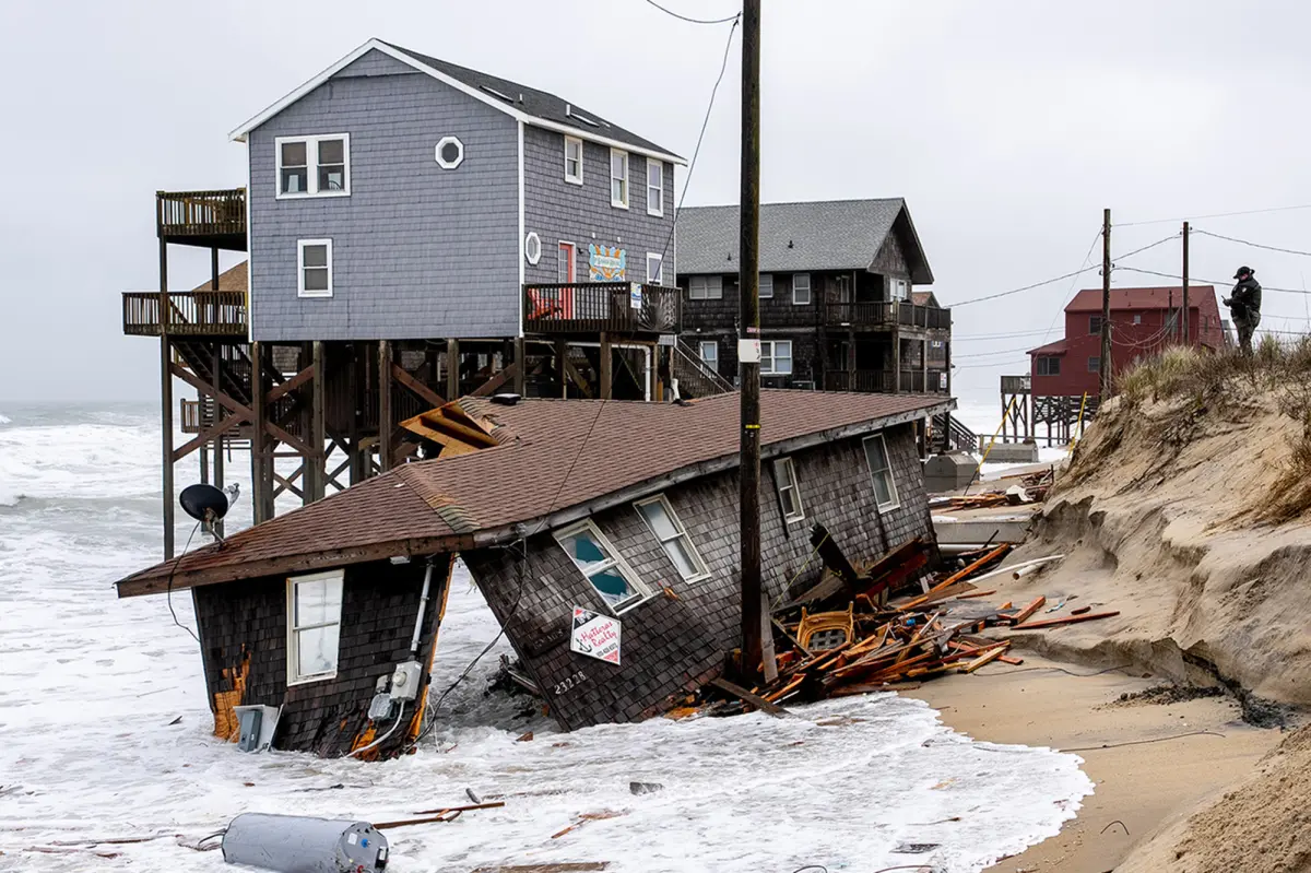
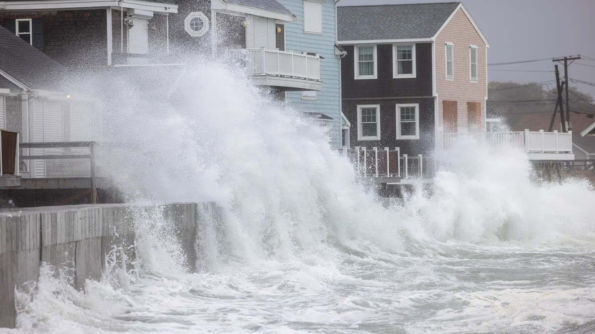
A powerful early-season nor’easter is battering North Carolina’s Outer Banks, where dozens of oceanfront homes are already in danger as the shoreline continues to advance inland. Officials caution that another wave of properties could soon face the same fate.
On Thursday, the National Park Service shut down the beach between Rodanthe’s northern boundary and its pier at Cape Hatteras National Seashore. The closure was prompted by “multiple threatened oceanfront structures” considered a danger to visitors.
For residents, the crisis is painfully familiar. Since 2020, erosion has contributed to the collapse of 32 homes, repeatedly shifting the coastline beneath the communities built along it.
The destruction has been centered largely in Rodanthe and Buxton, two small Hatteras Island communities located on the narrow, shifting barrier islands that form the Outer Banks.
During a state meeting last November, officials reported that about 100 structures in the two communities were being monitored because of their proximity to the ocean. They also warned that the list could grow.
“If every one of those structures falls in,” Cape Hatteras National Seashore Superintendent Dave Hallac said at the time, “there would be another 100 right behind them.”
Years of erosion have put more homes at the water’s edge
At least five additional homes have collapsed since Hallac issued that warning, according to National Park Service records. The latest storm is now subjecting many of the remaining vulnerable properties to another round of heavy surf and erosion.
On Thursday, unusually high tides pushed through the dunes on Pea Island north of Rodanthe, damaging approximately 500 feet of roadway and closing N.C. 12. The National Weather Service said waves could reach heights of 10 to 15 feet through Saturday evening.
The storm is striking a coastline that bears little resemblance to the one homeowners knew when many of these beachfront properties were constructed.
Michael McDaniel purchased his Buxton vacation home for roughly $500,000 in 2011. At the time, about 250 feet of dunes—almost the distance of a football field—stood between the house and the Atlantic Ocean.
Fifteen years of erosion have since consumed that protective stretch of sand, leaving the property uninhabitable.
McDaniel’s experience reflects a broader reality across the Outer Banks. These islands are naturally unstable barrier formations, made of thin bands of sand that shift as waves and coastal currents redistribute sediment.
In that sense, shoreline erosion is a normal feature of the islands’ constantly changing landscape.
Still, the pace of change can be severe. Dare County estimates that some sections of Rodanthe’s shoreline have moved inland by an average of about 13 feet each year. Historically, erosion in parts of Buxton has surpassed 20 feet annually.
Those yearly averages, however, do not capture the sudden and dramatic damage that can occur during major storms.
Hurricane Erin damaged 75 residential structures in Rodanthe and Buxton in August 2025. In the two months that followed, a series of offshore storms caused 16 homes to collapse.
As the shoreline retreats, it is overtaking neighborhoods developed when the ocean was considerably farther away. County records indicate that most of the homes now at risk were built during the 1980s and 1990s.
YOU MIGHT ALSO LIKE: SNL Returns With Skit Mocking Trump Aide Natalie Harp’s Friendship
Homeowners are running out of options
For homeowners watching the ocean approach, the available remedies are limited.
Flood insurance generally pays for physical damage directly caused by a covered flood, but the policy may not apply merely because erosion has left a house dangerously close to the water.
“The NFIP policy pays for a direct physical loss from flood,” Lisa Sharrard, a North Carolina flood insurance agent and Certified Floodplain Manager, told Realtor.com®. “So there has to [be] a flooding event, not normal high tide.”
“The SFIP does not cover damage caused by gradual erosion,” Sharrard adds.
That can leave homeowners like McDaniel in between a rock and a hard place: Stuck with a home they may no longer be able to safely use but one that has not yet suffered the kind of damage an insurance policy is designed to cover.
“If they have a policy, the policy may pay if the house collapses due to erosion,” Sharrard explains. “In the meantime, they have a house they cannot use and debris to clean up after. Most are trying to move if they can.”
Even when federal flood coverage does apply, the standard NFIP policy provides no more than $250,000 in building coverage for a single-family home—a sum that falls woefully short of what impacted homeowners need.
One Rodanthe couple previously told Realtor.com they spent more than $200,000 to move their house roughly 100 feet inland after erosion brought the ocean dangerously close. And they had something many threatened homeowners don’t: enough land left behind the house to put it somewhere else.
Protecting the shoreline costs millions—and doesn’t last forever
So where does that leave the homeowners farther back from the water—and the communities trying to keep them from becoming the next ones at risk?
One option is to try to keep the shoreline from reaching them.
But North Carolina prohibits most permanent seawalls, leaving communities to rely heavily on beach nourishment: the practice of pumping sand onto an eroding beach to try and rebuild a buffer in front of homes and roads.
Buxton spent about $18.1 million replenishing 2.9 miles of shoreline in 2022. Two years later, a coastal storm stripped away an estimated 175,000 cubic yards of sand. Engineers estimated replacing that loss alone would cost another $10.2 million.
So this summer, the dredges came back. By Sept. 16, crews had placed about 1.5 million cubic yards of new sand along Buxton—just over a week before the current nor’easter began pounding Hatteras Island.
Even under normal conditions, Dare County says nourishment projects generally last about five years before more sand is needed.
In Rodanthe, officials say even that solution is too expensive.
“In Rodanthe there isn’t enough money to solve the problem with beach nourishment,” Dare County Manager Bobby Outten told state coastal officials in November.
Meanwhile, the ocean is expected to keep rising. The Fifth National Climate Assessment projects 15 to 22 inches of sea-level rise around the Outer Banks by 2050, allowing future high tides and storms to reach farther inland.