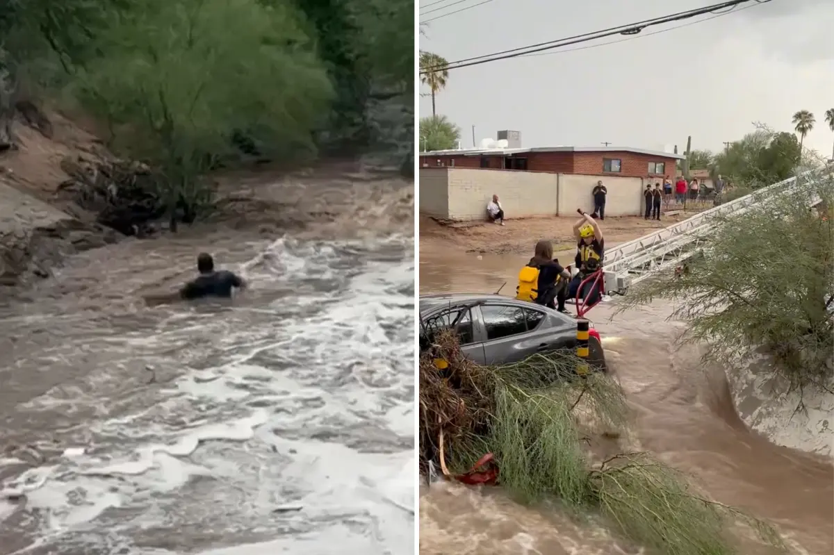

At least three people have died after torrential rain triggered dangerous flooding across parts of the southwestern United States, as a tropical disturbance adds moisture to the region’s monsoon pattern, officials said.
Arizona is facing an especially active and potentially hazardous weather day, with forecasters warning that intense flash flooding could threaten lives across large areas of the state.
Water rescues were underway in Scottsdale, where multiple vehicles became stranded in roughly two feet of standing water, according to the fire department. Similar rescues were also reported in the Phoenix area.
Ruidoso Municipal Schools in New Mexico closed all campuses Wednesday as severe weather and flooding created dangerous conditions throughout the region.
Communities across New Mexico have also been hit hard by the storm system, with heavy rainfall producing a significant flood threat for thousands of residents.
The flooding has been linked to three reported drowning deaths. Two adults and one child were found dead at the scene, authorities said.
A sprawling heat dome over the central and eastern United States is helping drive the wet pattern. According to the FOX Forecast Center, the heat acts like an atmospheric barrier, trapping persistent monsoon conditions along its western edge. The Southwest monsoon typically continues through the end of September.
That weather pattern is drawing a surge of tropical moisture into Arizona and New Mexico, fueling widespread thunderstorms and a Level 2 out of 4 flash flood risk through Friday morning.
Locations including Ruidoso and Phoenix could receive 2 to 3 inches of rain through Wednesday. Because of that potential, both areas have been placed under a higher Level 3 out of 4 flood threat.
Winds circulating around a high-pressure ridge east of the region are pulling tropical moisture northward from the Pacific. At the same time, upper-level disturbances moving along the western side of the heat dome are supplying the lift needed to generate additional storms.
With the moisture stream firmly established and unable to move away, thunderstorms are expected to develop repeatedly during the afternoon hours through Friday.
Flood Watches have been issued for broad sections of Arizona, southern Utah, and western and southern New Mexico as the threat of flash flooding continues.
The danger extends into Utah, including Zion National Park. Alerts cover major destinations such as Phoenix and Tucson in Arizona, as well as Ruidoso in New Mexico. Rain is expected to persist through Friday, with widespread totals of 1 to 2 inches and isolated amounts of 2 to 3 inches possible in higher elevations.
Forecasters are also watching the Gulf of California, where additional tropical influence could send more moisture into the Southwest.
Tropical disturbances in the Gulf of California are unusual and are considered unlikely to strengthen into a named storm or tropical depression, according to the National Hurricane Center.
As this moves onshore into Mexico on Wednesday, its moisture will surge northward into the Four Corners region and increase the coverage of widespread showers and storms.
As these storms bring repeated rainfall over the next few days, the overly saturated soil will not be able to absorb much precipitation and flooding will likely follow.
“Storms will produce high hourly rain rates, driving a persistent risk for severe flash flooding, rapid runoff into desert arroyos, mudslides in steep terrain and dangerous debris flows over recent burn scars across both states through the week,” the FOX Forecast Center said.
Monsoon rain can often trigger mudslides, which makes this flood threat even more dangerous and worth monitoring throughout the week, as conditions could change or worsen.


