
Share this @internewscast.com

Rising sea levels due to climate change may pose a greater threat to tens of millions more people than previously estimated, according to a recent study. This discrepancy arises from earlier research assumptions that underestimated the current height of coastal waters.
After reviewing hundreds of scientific studies and risk assessments, researchers found that approximately 90% of these analyses underestimated the baseline height of coastal waters by about one foot (30 centimeters). This finding was detailed in a study published on Wednesday in the journal Nature.
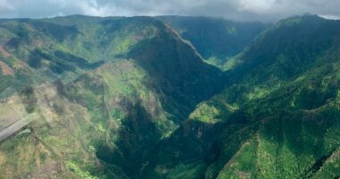
This issue is particularly prevalent in the Global South, as well as in regions such as the Pacific and Southeast Asia, while Europe and the Atlantic coasts are less affected.
The discrepancy stems from differences in how sea and land altitudes are measured, explained study co-author Philip Minderhoud, a hydrogeology expert from Wageningen University & Research in the Netherlands. He referred to this as a “methodological blind spot” due to the diverging measurement techniques for sea and land levels.
While each method accurately measures its respective area, complications arise at the interface of sea and land. Factors often go unaccounted for when combining satellite and land-based measurements.
Lead author Katharina Seeger from the University of Padua in Italy noted that studies predicting the impacts of rising sea levels frequently do not consider actual measured sea level data, instead using a theoretical “zero-meter” baseline. In certain areas of the Indo-Pacific, actual sea levels can be nearly three feet (one meter) higher, according to Minderhoud.
One simple way to understand that is that many studies assume sea levels without waves or currents, when the reality at the water’s edge is of oceans constantly roiled by wind, tides, currents, changing temperatures and things like El Niño, said Minderhoud and Seeger.
Adjusting to a more accurate coastal height baseline means that if seas rise by a little more than three feet (one meter) — as some studies suggest will happen by the end of the century — waters could inundate up to 37% more land and threaten 77 million to 132 million more people, the study said.
That would trigger problems in planning and paying for the impacts of a warming world.
People at risk
“You have a lot of people here for whom the risk of extreme flooding is much higher than people thought,’’ said Anders Levermann, a climate scientist at the Potsdam Institute for Climate Impacts Research in Germany, who wasn’t part of the study. And Southeast Asia, where the study finds the biggest discrepancy, has the most people already threatened by sea level rise, he said.
Minderhoud pointed to island nations in that region as an area where the reality of discrepancy hits home.
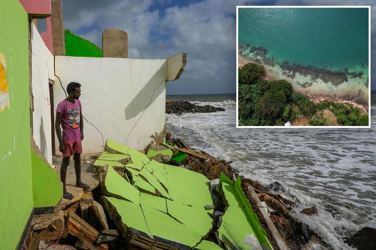
For 17-year-old climate activist Vepaiamele Trief, the projections aren’t abstract. On her island home in the South Pacific archipelago of Vanuatu, the shoreline has visibly retreated within her short lifetime, with beaches eroded, coastal trees uprooted and some homes now barely three feet (about one meter) from the sea at high tide.
On her grandmother’s island of Ambae, a coastal road from the airport to her village has been rerouted inland because of encroaching water. Graves have been submerged and entire ways of life feel under threat.
“These studies, they aren’t just words on a paper. They aren’t just numbers. They’re people’s actual livelihoods,” she said. “Put yourself in the shoes of our coastal communities — their lives are going to be completely overturned because of sea level rise and climate change.”
Paying attention to the starting point
This new study is pretty much about what the truth is on the ground.
Calculations that may be correct for the seas overall or for the land aren’t quite right at that key intersection point of water and land, Seeger and Minderhoud said. It’s especially true in the Pacific.
“To understand how much higher a piece of land is than the water, you need to know the land elevation and the water elevation. And what this paper says the vast majority of studies have done is to just assume that zero in your land elevation dataset is the level of the water. When in fact, it’s not,” said sea level rise expert Ben Strauss, CEO of Climate Central. His 2019 study was one of the few the new paper said got it right.
“It’s just the baseline that you start from that people are getting wrong,” said Strauss, who wasn’t part of the research.
Maybe not so bad, some scientists say
Other outside scientists said that Minderhoud and Seeger may be making too much of the problem.
“I think they’re exaggerating the implications for impact studies a bit — the problem is actually well understood, albeit addressed in a way that could probably be improved,” said Gonéri Le Cozannet, a scientist at the French geological survey.
Most local planners know their coastal issues and plan accordingly, Rutgers University sea level expert Robert Kopp said.
That’s true in Vietnam in the high-impact area, Minderhoud said. They have an accurate sense of elevation, he said.
The findings come as a new UNESCO report warns of major gaps in understanding how much carbon the ocean absorbs. That report said that models differ by 10% to 20% in estimating the size of that carbon sink, raising questions about the accuracy of global climate projections that rely on them.
Together, the studies suggest governments may be planning for coastal and climate risks with an incomplete picture of how the ocean is changing.
“When the ocean comes closer, it takes away more than just the land we used to enjoy,” said Thompson Natuoivi, a climate advocate for Save the Children Vanuatu.
“Sea level rise is not just changing our coastline, it’s changing our lives. We are not talking about the future — we’re talking about the right now.”