
Share this @internewscast.com
Get ready for a gusty start to the week!
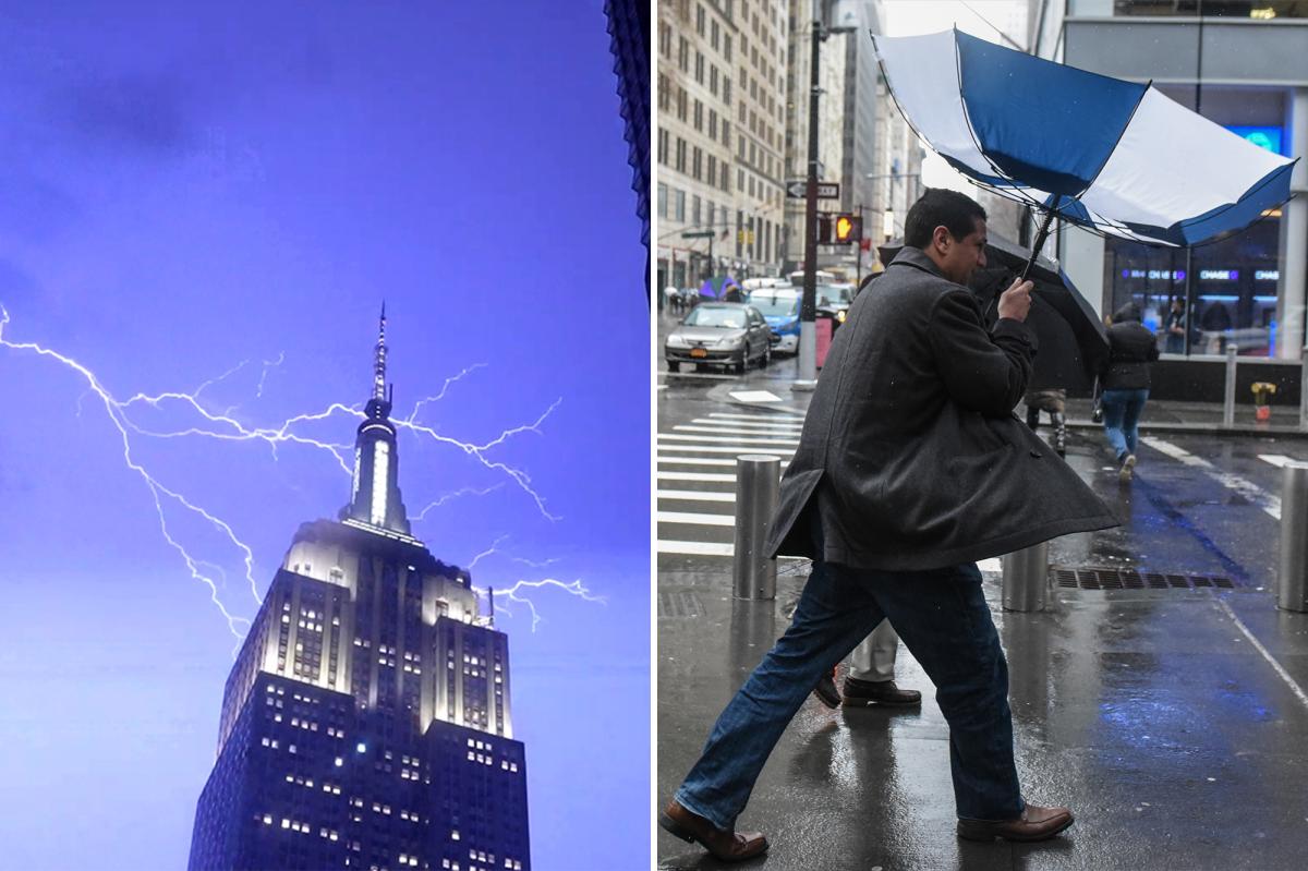
New York City is bracing for strong winds on Monday as a cold front sweeps through the area, bringing rain and potential thunderstorms, according to weather forecasts.
Residents should prepare for showers, lightning, and thunder to descend upon the city starting around 2 p.m. following a round of downpours on Sunday night, AccuWeather’s Senior Meteorologist, Carl Erickson, informed The Post.

A “narrow squall line” is expected to pass through the city, delivering powerful wind gusts and additional rainfall. This weather system is likely to impact the Monday evening commute before moving eastward by 2 a.m., Erickson explained.
“As the cold front arrives, the likelihood of localized damaging wind gusts will rise later in the evening,” Erickson stated on Sunday.
“The primary concern is those localized damaging wind gusts,” he noted, adding that brief, heavy downpours could lead to urban flooding, particularly in areas with poor drainage.
Empty tractor-trailers and tandem trucks will be banned on MTA bridges starting at 4 p.m. on Monday due to high winds expected to reach 50 miles per hour, according to the city Emergency Management Department.

Temperatures on Monday will still be mild, in the low 60s, but the mercury will struggle to reach the 40s on Tuesday, forecasters said.
“Once we get past 1 or 2 o’clock in the morning tomorrow night, most of the rain and thunderstorms will be off to the east, and then it’ll just be windy throughout the day on Tuesday, but also a lot colder,” Erickson said.
Residents should stay vigilant for any updates on road and transit conditions throughout Monday night as stormy conditions persist, meteorologists warned.