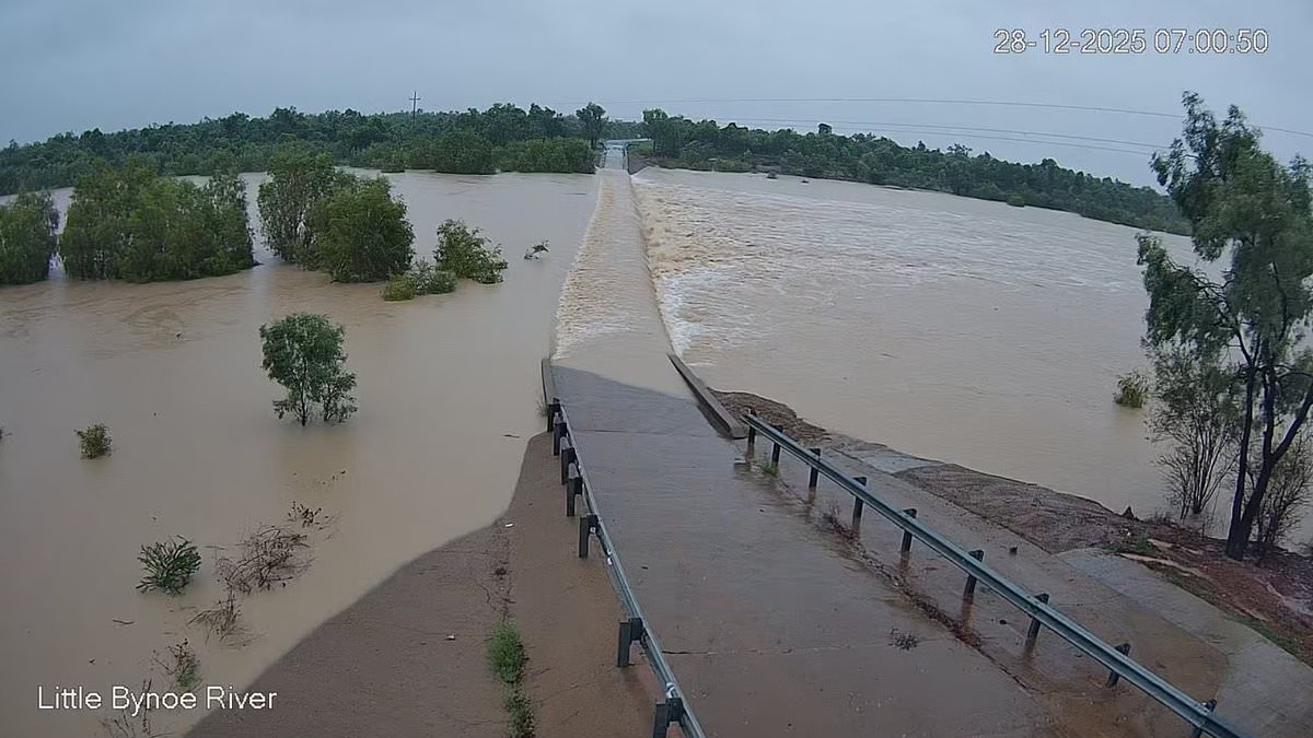

Authorities have issued flood warnings in the Northern Territory, as surging waters pose a threat to cut off communities and leave travelers stranded.
In preparation, sandbagging stations have been set up, with residents in the far north bracing for a deluge. A slow-moving monsoon could potentially bring as much as 700mm of rain to the area.
A significant weather trough is stretching from the Top End across into Queensland, expected to intensify and lead to widespread rain and thunderstorms.
The Bureau of Meteorology reported on Sunday that the most intense rainfall will likely hit Queensland’s Gulf Country, impacting areas such as Mount Isa and Julia Creek.
Communities along Queensland’s tropical coast, from Cairns to just north of Townsville, are also on high alert. Flood watch warnings are in effect for the Barkly and Carpentaria Catchments in North-Western Queensland and the North Tropical Coast.
Forecaster Jonathan How noted that for this coastal region, peak rainfall totals over six-hour periods are anticipated to increase from Sunday night into Monday, potentially reaching between 120 to 200 millimeters.
‘Thunderstorms could deliver even higher rainfall totals, and we expect heavy rain to continue through Monday and possibly beyond.’
The bureau said heavy rain and flooding would pose a risk to property and life, bringing road closures and community isolation for outback and more remote communities.

Northern Queensland is on flood alert as heavy rainfalls are forecast across the region

Some communities are at risk of being cut off as flooding breaks out across the region
Authorities warn that Mount Isa, Cloncurry, Burketown and Normanton are at particular serious risk of flooding.
These areas could see 100mm to 200mm of rain, with isolated peaks hitting 250mm in the next day.
Rainfall totals will climb as the weather system moves across the state with up to 700mm falling in isolated areas, Mr How said.
Sandbagging stations have opened in the Mt Isa and Hinchinbrook areas, with locals urged to take added precautions.
Popular tourist destination Hinchinbrook remains in the firing line, and Mayor Ramon Jayo said the worst was expected from Monday.
‘Despite the extensive rain experienced … river levels remain below minor at the present time and modelling suggests that the most likely scenario is that some will remain about such level into Monday morning at this stage,’ Mr Jayo said on social media.
‘However, it is critical to understand that this circumstance may change rapidly dependent upon where the convergence settles and (what) rainfall is experienced and this situation will be monitored closely.’

Residents in low-lying areas have been urged to protect their property from floodwaters

The heaviest falls will be concentrated near Mount Isa and Julia Creek according the Bureau

Falls of over 200mm were recorded in just three hours to midday on Sunday morning
Residents in low-lying areas have been urged to protect their property if drainage systems struggle to clear water in torrential downpours.
Downpours have already drenched parts of the state.
In just three hours to midday Sunday, Lower Walker Creek copped 50mm, Broadwater soaked up 47mm, and Glenore Weir was hit with 42mm.
Wills Development Road recorded 40mm, while Cartridge Creek and Neumeyer Valley Station saw 34mm and 30mm respectively.
Earlier, the rain was even heavier. Gairloch, north of Ingham, was smashed with 200mm, while Cardwell Gap, just south of Tully, recorded a staggering 217mm. Ingham itself has been drenched with 185mm since Saturday morning.
Further inland, Paradise Lagoon near Mount Isa was hammered with 174mm, and more than 120mm fell across Walkers Bend, Flinders–Cloncurry Junction, Wondoola, Lower Walker Creek, Allingham Forrest Drive, Wallaman, Poverty Hill, Halifax and Nash’s Crossing.