Share this @internewscast.com
While state laws differ, drivers can still incur fines or citations if snow or ice obstructs their view or causes dangers on the road.
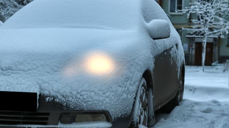
WASHINGTON — In the aftermath of a snowstorm, many drivers clear just enough snow from their windshields to see, leaving snow and ice covering the rest of their vehicles. But is this practice actually legal?
The legality hinges on your location.
There isn’t a nationwide mandate requiring drivers to remove snow or ice from their vehicles. Instead, this issue is managed at the state level, with many regions relying on general traffic regulations rather than specific snow-related laws.
In Washington D.C., Maryland, and Virginia, there are no explicit laws mandating drivers to remove snow from their car roofs, as confirmed by the police departments in these areas.
However, this doesn’t entirely exempt drivers from responsibility.
Instead of snow-specific statutes, officers often may rely on existing traffic laws, such as those governing obstructed views, unsecured loads or unsafe vehicles. In those cases, drivers can be cited if snow or ice blocks visibility, falls onto other vehicles, or otherwise poses a danger on the road.
In Maryland, for example, transportation law prohibits driving a vehicle if it is loaded in a way that obstructs the driver’s view or interferes with control of the vehicle. While the statute does not mention snow, it can apply if snow or ice blocks visibility or creates a hazard.
Some states have passed laws that specifically address snow or ice falling from vehicles, while others enforce the issue through broader safety regulations. In either case, drivers may be held responsible if snow or ice causes damage or injury.
In New Jersey, drivers can be fined $25 to $75 for failing to remove snow or ice from their vehicles, even if none of it falls off. If snow or ice dislodges and causes property damage or injury, fines increase to between $200 and $1,000.
In Ohio, officers enforce the issue through general safety laws rather than a snow-specific statute. Snow on the roof of a car is not automatically illegal, but drivers can be cited if their vehicle is considered unsafe or if snow or ice falls and causes damage. And if snow or ice falls from a vehicle and damages another car, drivers could face a minor misdemeanor charge.
Even without a specific law, officials say clearing snow and ice from vehicles is strongly recommended, as doing so can help prevent crashes, fines and injuries.