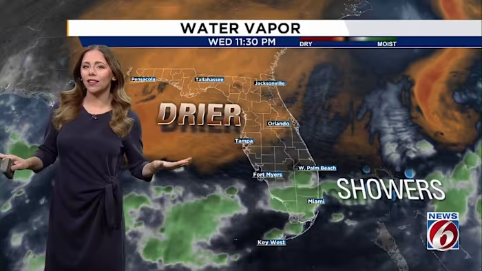
ORLANDO, Fla. – Central Florida is getting a short-lived break from the humidity and frequent storms. Take advantage of the drier weather today, because showers and thunderstorms are expected to return this weekend.
Thursday & Friday
Breezy conditions will continue over the next several days. Northeast winds are forecast to strengthen to 15 to 20 mph this afternoon, with gusts reaching roughly 25 to 30 mph.
A push of drier air will limit rainfall for much of the area, bringing rain chances down to between 20% and 30%.
Temperatures should feel somewhat more comfortable, with afternoon highs in the mid to upper 80s. Locations near and northwest of I-4 may notice lower humidity as dew points fall into the upper 60s.
Beachgoers should use caution, as coastal conditions remain dangerous. The risk of life-threatening rip currents is high, while rough surf and hazardous boating conditions are also expected.
Weekend
The weather pattern will shift heading into the weekend as moisture builds and an upper-level low moves across Florida.
As a result, scattered to numerous showers and thunderstorms are likely each day, with rain chances rising to 70% to 80%.
Some storms could become strong, producing frequent lightning, wind gusts of 40 to 50 mph and locally heavy rainfall totaling 1 to 3 inches. Minor flooding may develop, particularly in areas that receive repeated rounds of heavy rain.
Seasonable temperatures are expected to hold, with highs in the upper 80s and overnight lows in the 70s.

The News 6 Weather team keeps you informed about the latest conditions and what to expect throughout the day.


