

Heat indices 100-105 degrees.
ORLANDO, Fla. – Sunday
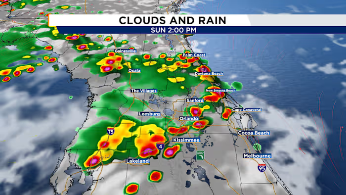
Central Florida’s Sunday Funday will bring another steamy afternoon, but conditions should stay just below heat advisory criteria. Afternoon highs are expected to climb into the mid-90s, with feels-like temperatures ranging from 100 to 105 degrees. Rain chances will also improve, thanks to a stronger westerly steering flow that should help push showers and storms toward the I-4 corridor and areas farther east later in the day.
Spotty storms are expected to begin developing near I-75 around midday before moving east toward I-4 between about 2 and 3 p.m. Rain chances will then shift toward the Atlantic coast beaches through the second half of the afternoon. Most storms should weaken and taper off near sunset.
Next Week
Another plume of Saharan dust is expected to move into Central Florida next week. As it arrives, the atmosphere will dry out, and temperatures will trend even hotter.
Rain chances will gradually decrease by about 10% each day, falling to around 20% by Wednesday. At the same time, afternoon temperatures will return to the upper 90s, with heat index values likely pushing above 105 degrees.