

ORLANDO, Fla. – Central Florida saw a little bit of everything on Saturday, from heat advisories and mid-to-upper 90s temperatures to scattered storms mainly between I-4 and I-75. In Marion County, a few storms turned severe, leaving behind notable damage in some communities. See the damage HERE. Spotty storms may continue into the early evening through about 9 p.m., with only an isolated shower possible after that. By 10 p.m., conditions should turn dry for the remainder of the night under passing clouds, with lows settling in the mid-to-upper 70s.
Sunday
Sunday Funday will still bring a steamy afternoon, but there is some improvement. Temperatures are expected to stay below heat advisory criteria, so the heat should feel a bit less intense than Saturday. Afternoon highs will reach the mid-90s, with feels-like temperatures ranging from 100 to 105ºF. Rain chances also look better, as a stronger west-to-east steering flow should help push storms toward the I-4 corridor and areas farther east during the afternoon.
A few storms should begin developing near I-75 around midday, then shift east toward I-4 between about 2 and 3 p.m. Rain chances will continue spreading toward the Atlantic beaches through the second half of the afternoon. The activity is expected to weaken and taper off around sunset.
Next Week
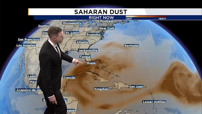
Another round of Saharan dust is forecast to move into Central Florida next week. That will help dry out the atmosphere while also allowing temperatures to climb.
Rain chances will decrease by about 10% each day, eventually dropping to around 20% by Wednesday. At the same time, afternoon temperatures will surge back into the upper 90s, with heat index values rising above 105ºF.


