

Tropical moisture lingers, but exciting changes lie ahead for next week.
ORLANDO, Fla. – Central Florida is bracing for another day of tropical moisture that promises to bring showers and storms to the area this afternoon.
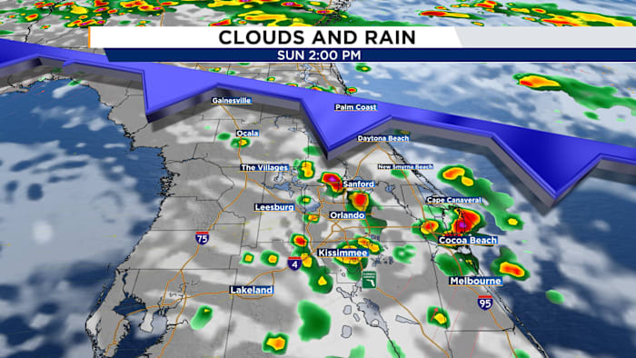
While the morning hours will remain relatively calm and dry, with just a blanket of clouds, the scene is set to change around midday. As a weather front moves southward into Flagler County, expect scattered showers and thunderstorms to develop. The main areas affected will stretch from Volusia County down through Osceola County, concentrating particularly between I-4 and I-95. These weather disturbances will persist until sunset, after which a tranquil Sunday evening is anticipated.
As we move into Monday, the weather pattern looks set to repeat itself. Once again, the morning will remain mostly dry, but scattered showers and storms are expected to re-emerge across Central Florida during the afternoon.
Looking ahead to the latter part of the week, significant changes are on the horizon. A trough of low pressure will help usher a backdoor cold front through Central Florida, transforming the atmosphere. By the weekend, residents can look forward to enjoying drier air, less humidity, and an abundance of sunshine. Morning temperatures are expected to dip into the 60s, offering a refreshing change to round off the week.