

On a March afternoon, an artificial intelligence system identified a suspicious plume on a live camera feed from Arizona’s Coconino National Forest. Upon confirmation by human analysts that it wasn’t just clouds or dust, a warning was issued to the state’s forest service and its primary electric utility.
This alert came from one of several AI-enabled cameras installed by Arizona Public Service, the state’s largest electric utility. These cameras detected the initial signs of what would later be called the Diamond Fire. Thanks to this early warning, firefighters swiftly responded and managed to contain the blaze before it expanded beyond 7 acres (or 2.8 hectares).
Amidst record-breaking temperatures and a worrying lack of snowpack, states across the wildfire-prone western United States are increasingly turning to artificial intelligence for early wildfire detection. This technological advancement is seen as a vital tool in safeguarding communities and preventing devastating loss of life and property.
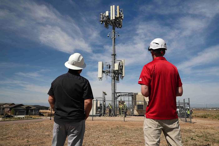
Currently, Arizona Public Service operates nearly 40 AI smoke-detection cameras and has plans to expand this network to 71 by the end of the summer. The state’s fire agency has also deployed seven cameras. Meanwhile, Xcel Energy in Colorado has installed 126 cameras and aims to cover seven out of the eight states it services by the end of the year.
“Earlier detection allows us to dispatch aircraft and personnel quickly, helping us keep fires as small as possible,” explained John Truett, the fire management officer for the Arizona Department of Forestry and Fire Management.
In areas where human surveillance is limited, artificial intelligence steps in to identify potential fires, enhancing the overall effectiveness of wildfire monitoring efforts.
ALERTCalifornia is a network of some 1,240 AI-enabled cameras across the Golden State that work similar to the system in Arizona.
Human intervention keeps the risk of false positives low and trains the technology to become more accurate, said Neal Driscoll, geology and geophysics professor at the University of California, San Diego, and founder of ALERTCalifornia.
“The AI that’s being run on the cameras is actually beating 911 calls,” he said.
In Arizona, California and beyond, the technology is mostly used in high-risk areas that are sparsely populated, rural or remote, where a blaze might not be quickly spotted by human eyes.
“It’s just the ones where we won’t get a 911 call for a long time, it is extremely helpful to have that AI always monitoring that camera,” said Brent Pascua, battalion chief for the California Department of Forestry and Fire Protection, or Cal Fire. “In many cases, we’ve started a response before 911 was even called, and in a few cases, we’ve actually started a response, went there, put the fire out, and never received a 911 call.”
A technology driven by worsening blazes
Pano AI, whose technology combines high-definition camera feeds, satellite data and AI monitoring, has seen a growing interest in its cameras since launching in 2020. They’ve been deployed in Australia, Canada and 17 U.S. states, including Oregon, Washington and Texas. Its customers include forestry operations, government agencies and utilities, including Arizona Public Service.
Last year, its technology detected 725 wildfires in the U.S., the company said.
“In many of these situations, we hear from stakeholders that the visual intelligence, the time, really, really gives them a head start and some of these could have taken off into hundreds if not thousands of acres,” said Arvind Satyam, the company’s co-founder and chief commercial officer.
Cindy Kobold, an Arizona Public Service meteorologist, said the technology notifies them about 45 minutes faster on average than the first 911 call.
Satyam said development of the technology was driven by the lack of hardened solutions to combat worsening wildfires. Climate change — caused by burning oil, gas and coal — is warming the planet and fueling dry conditions that supercharge infernos, making them burn hotter, faster and more frequently. The technology helps firefighters to safely and effectively respond while protecting communities and infrastructure, he said.
Challenges and limitations
One of the biggest obstacles to implementation is the price tag; Pano AI, for instance, charges around $50,000 annually per camera. The cost also includes fire risk analysis and 24/7 intelligence center.
False alarms present a challenge, which can be costly in terms of time and attention, said Patrick Roberts, a senior researcher with the nonprofit research group RAND who recently finished a project on accelerating innovation in wildfire management.
And when the AI accurately detects a fire, it doesn’t tell stakeholders the best course of action.
“Do you send help right away? Do you monitor? Should you worry about it? Where do you send help? Do you think about evacuation? All this still requires people and decision support systems,” said Roberts.
In highly populated areas, people tend to spot and call in fires pretty quickly, and the tech is not so useful when extreme weather events, such as hurricane-force winds, intensify and rapidly shift the flames, as happened in Los Angeles last year.
Pascua says the technology complements Cal Fire’s work.
“As the fire moves and shifts around, that’s where the human factor comes in and decides which tactics are best in fighting the fire. AI can only do so much,” he said. “It just provides that real time information where we can make better decisions on the fire ground.”
AI firefighting assistance is not limited to detection
AI can also be employed to identify the best places to thin vegetation and burn cool fires, and even to monitor air quality for signs of smoke, just like your home’s carbon monoxide sensor, said Roberts, but “1,000 times more sensitive.”
At George Mason University in Virginia, professor Chaowei “Phil” Yang is working with researchers from California State University of Los Angeles, the city of LA and NASA Jet Propulsion Laboratory to create a system that forecasts where a fire will burn and which communities will be hardest hit by smoke pollution.
The idea is to give agencies real-time maps so they can make quick, life-saving decisions about evacuations, school and road closures, and send out early air quality warnings. Yang said they hope the technology will be operational in three years.
“AI in wildfires, it’s no longer just speculative. It’s really being used,” said Roberts, and it’s use will only continue to grow.
“The future is AI everywhere,” he said, “and the lines will blur between AI wildfire detection and just wildfire detection as the lines will blur in other areas of our life.”
___
The Associated Press receives support from the Walton Family Foundation for coverage of water and environmental policy. The AP is solely responsible for all content. For all of AP’s environmental coverage, visit