
Share this @internewscast.com
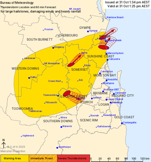
Residents of South-East Queensland should prepare for severe thunderstorms as a weather warning has been issued for Ipswich, Somerset, the Lockyer Valley, and the Sunshine Coast.
These storms, capable of producing damaging winds, heavy rainfall, and large hail, have been detected moving in a north-easterly direction. The affected areas include regions from Coolum Beach on the Sunshine Coast toward Noosa Heads, as well as from Eumundi to Tewantin. Additionally, storms are moving southeast from Helidon to Gatton, Grantham, Linville, Laidley, Grandchester, and Mulgowie in the Somerset Region.
A broader severe thunderstorm warning is also in place for parts of the Wide Bay and Burnett, Darling Downs and Granite Belt, and Southeast Coast districts.

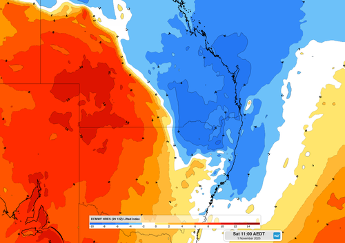
Ben Domensino from Weatherzone has indicated that the intensity of these storms is expected to increase on Saturday.
“Storms could develop early in the morning over eastern parts of NSW and Queensland on Saturday, before becoming more widespread and intense during the afternoon into the evening,” Domensino explained.
“Saturday’s storms will be most active between central eastern Queensland and central New South Wales, potentially affecting both Brisbane and Sydney.”
“Supercell thunderstorms are possible on Saturday, and isolated tornadoes can’t be ruled out.”

Some areas may see a thunderstorm each day for up to six days, he said.
The thunderstorms are the result of an an upper-level through that may culminate in several days of rain across central, eastern and southeastern Australia early next week.