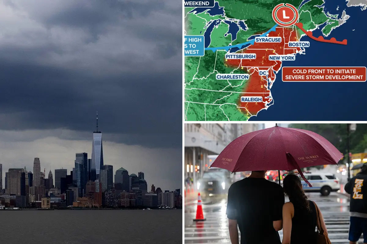

A round of powerful weekend storms is forecast to sweep into the East Coast, bringing the potential for thunderstorms, hail, strong wind gusts and even isolated tornadoes — while also offering a break from the recent stretch of heat and smoky skies.
Hot, humid air has returned to parts of the East Coast, but dense smoke drifting south from Canadian wildfires could complicate temperature forecasts by limiting how much the region heats up each day.
Relief is on the way, however, as the stagnant, smoky weather pattern is expected to shift once storms arrive this weekend.
A heat dome settled over the East Coast will continue to keep conditions steamy through Friday, with high humidity adding to the discomfort. Still, the widespread wildfire smoke remains an unpredictable factor in determining afternoon highs.
According to the FOX Forecast Center, the thick smoke layer can behave like a screen in the atmosphere, scattering and reflecting sunlight before it reaches the ground and drives temperatures higher.
By the weekend, a slow-moving cold front is expected to push across the East Coast, helping to break down the hot and hazy setup.
The front will spark numerous heavy showers and thunderstorms, first developing Friday in the Ohio Valley before spreading into parts of the Mid-Atlantic through Sunday.
The storms may produce damaging winds, torrential rainfall and frequent lightning, with Saturday currently standing out as the day with the highest severe weather concern.
ALSO READ: Man Accused of Calmly Shooting Mother’s Partner During Dispute Over Slammed Door
A Level 2 out of 5 severe storm threat extends throughout most of the Northeast and southeastern Great Lakes.
An intense line of storms will develop across western parts of the Northeast late evening on Saturday and move eastward through the overnight hours, the FOX Forecast Center said.
Large, damaging hail will be the primary threat early on. However, once the storms transition into a line, damaging wind gusts will become the main hazard. A few tornadoes are also possible.
As the cold front continues its eastward progress farther south, severe storms will also be likely across Western Virginia and North Carolina, where there is a Level 2 out of 5 severe storm threat on Sunday.
In addition to the storm threat, a flash flooding threat stretches across the Ohio Valley on Friday.
On Saturday, the flood threat includes a large portion of the Northeast, where a level 2 flood threat is in effect for New York City, parts of Pennsylvania and New Jersey.
On Sunday, a level 1 flash flood threat is in place for parts of Virginia and North Carolina.
For New York City, rainy weekends have become all too familiar this summer.
Central Park has recorded measurable rain every single weekend since the beginning of June, and if the current forecast holds, that streak will likely continue.