
CHICAGO (WLS) — The Chicago area is bracing for more rain and thunderstorms on Wednesday, according to forecasts.
ABC7 Accuweather Meteorologist Tracy Butler predicts that heavy rain showers and scattered storms will persist through Wednesday morning.
ABC7 Chicago is now streaming 24/7. Click here to watch
As the day progresses, temperatures are expected to rise, offering some respite with dry periods before storms return in the evening, Butler noted.
These evening storms carry the potential to become severe, with strong winds, hail, and flooding being the primary concerns, Butler warned.
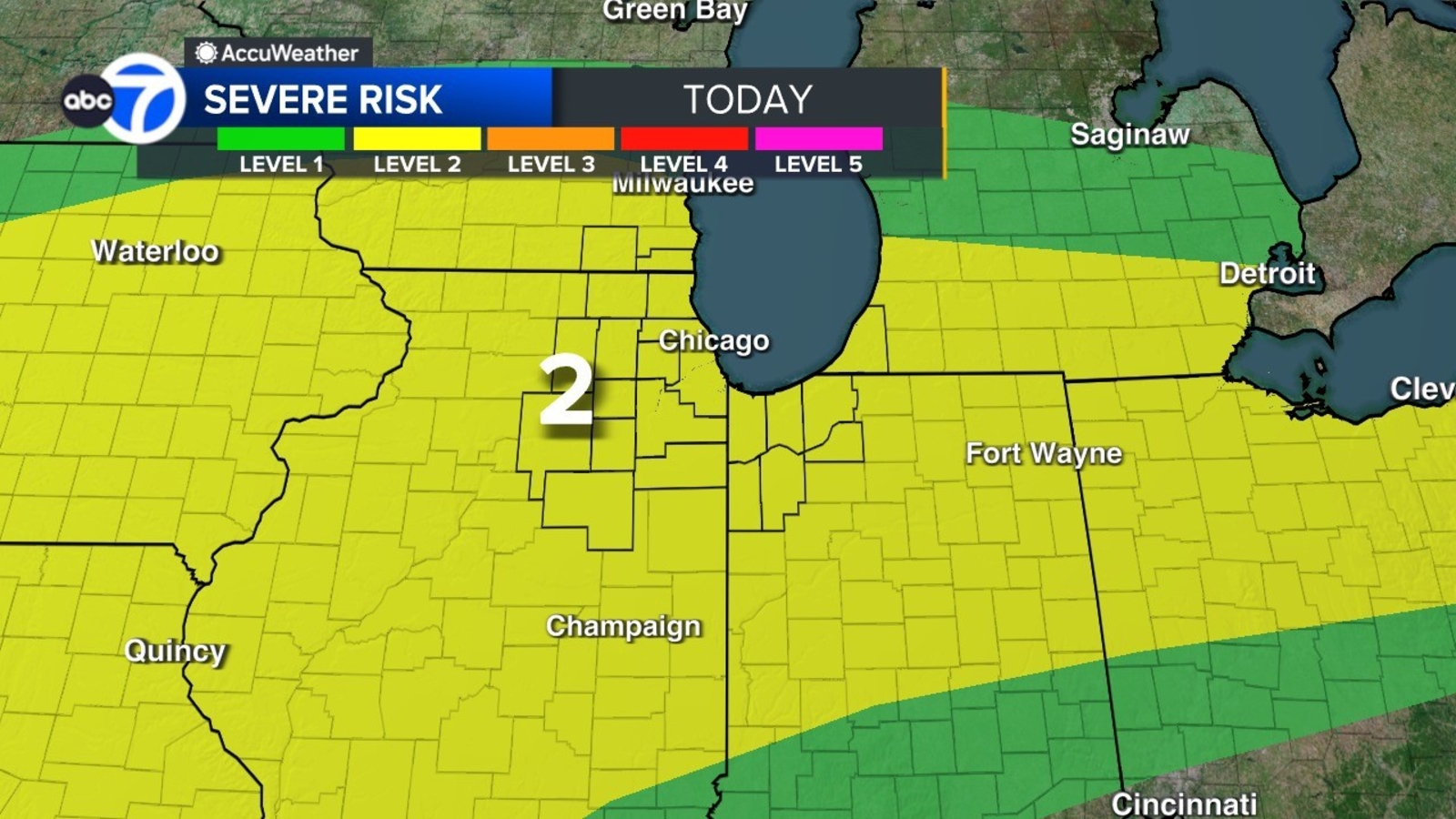
The Storm Prediction Center has placed the entire Chicago region under a Level 2 risk for severe weather on Wednesday.
This weather follows a similarly stormy day on Tuesday, which was marked by rain and thunderstorms.
Heavy storms moved through the north and northwest suburbs late Tuesday night into the early morning hours.
The storms led to heavy rain, lightning, flooding, and some downed trees.
In Zion, Route 173 is closed between Delaney and Kilbourne roads for reports of cars stuck in standing water.
Video from Elgin shows a large tree that crashed down on several vehicles at Chicago & Worth.
Elgin police warned people about multiple weather sirens due to the storm that was caused by 75 mph winds and golf ball size hail.
Route 31 was also pretty flooded and more lightning lit the sky in Huntley.
Non-stop heavy rain covered the north and northwest suburbs in Woodstock, as well, slowing down drivers, as water pooled on the streets.
Cook County Radar DuPage County Radar Will County Radar Lake County Radar (IL) Kane County Radar Northwest Indiana Radar
Copyright © 2026 WLS-TV. All Rights Reserved.